Peru’s UNESCO World Heritage Sites
Peru has thirteen World Heritage properties, not twelve, and one of them is closed to tourists altogether. Here is the honest list, with fees, travel times, how long each site needs, and three routes that actually work.
Almost every list of Peru UNESCO sites you will find online was assembled from the UNESCO website in an afternoon by someone who has been to three of them. You get a paragraph of encyclopaedia prose per site, a stock photo, and no answer to the only questions that matter when you are planning: can I actually get in, how long does it take, and is it worth the detour. Some of those lists are also simply out of date and still say twelve.
The correct number, as of 2026, is thirteen. Nine cultural, two natural, two mixed. Peru ratified the World Heritage Convention in February 1982 and got its first two inscriptions the following year. The most recent addition was in 2021. I have been to nine of the thirteen, tried and failed to arrange access to one, and can tell you with some confidence that one of them is not visitable by tourists in any normal sense of the word.
The full list of Peru UNESCO sites at a glance
This is the table I wanted when I was planning and could not find. Years are inscription years; where two are given, the second is an extension of the property. “Days needed” means door to door from the nearest city you would sensibly base in, not time spent standing on the site.
| Site | Region | Type | Listed | Can you visit? | Days needed |
|---|---|---|---|---|---|
| Historic Sanctuary of Machu Picchu | Cusco | Mixed | 1983 | Yes, timed ticket, daily cap | 1–2 |
| City of Cuzco | Cusco | Cultural | 1983 | Yes, it is a working city | 2–3 |
| Chavin (Archaeological Site) | Ancash | Cultural | 1985 | Yes, long day trip from Huaraz | 1 |
| Huascaran National Park | Ancash | Natural | 1985 | Yes, ticketed, several entrances | 2–6 |
| Chan Chan Archaeological Zone | La Libertad | Cultural | 1986 | Yes, one palace open, still In Danger | 1 |
| Manu National Park | Madre de Dios / Cusco | Natural | 1987 | Partly — zoned, core off limits | 5–8 |
| Historic Centre of Lima | Lima | Cultural | 1988, 1991 | Yes, free to walk | 1 |
| Rio Abiseo National Park | San Martin | Mixed | 1990, 1992 | Effectively no — closed to tourism | n/a |
| Lines and Geoglyphs of Nasca and Palpa | Ica | Cultural | 1994 | Yes, best from the air | 1–2 |
| Historical Centre of Arequipa | Arequipa | Cultural | 2000 | Yes, free to walk | 2–3 |
| Sacred City of Caral-Supe | Lima region | Cultural | 2009 | Yes, and almost nobody does | 1 |
| Qhapaq Nan, Andean Road System | Multiple, 6 countries | Cultural | 2014 | Sort of — you walk a segment | 1–4 |
| Chankillo Archaeoastronomical Complex | Ancash | Cultural | 2021 | Yes, but you need a car or a tour | 1 |
Two things jump out of that table. The first is that eleven of the thirteen are genuinely visitable by an ordinary traveller with an ordinary budget, which is a better hit rate than most countries with a comparable list. The second is that the distribution is lopsided in a way that has nothing to do with quality. Machu Picchu takes roughly 1.5 million people a year. Caral, which is a thousand years older than anything in Cusco and arguably the more important archaeological property, takes around 25,000. That is not a typo.
What the World Heritage label actually means, and what it does not
Inscription is not a rating. UNESCO is not saying these are the thirteen best places in Peru, and there are things in this country I would rather spend a day on than the Historic Centre of Lima. What the Committee is saying is that each property meets at least one of ten criteria for “outstanding universal value” and that the Peruvian state has committed to protecting it. Criteria one to six are cultural, seven to ten are natural, and a property that satisfies both sets is classed as mixed. Peru has two mixed properties, which is unusual; there are fewer than thirty in the world.
There is also a second list nobody mentions in these round-ups: the List of World Heritage in Danger. Chan Chan has been on it since 1986, which is the same year it was inscribed. It went straight on because the adobe is dissolving. El Nino rains, wind erosion, looting and a highway through the buffer zone. Peru is working through a conservation master plan running to 2031 with the aim of getting it removed. As of 2026 it is still on the danger list, and you can see why the moment you stand next to a wall that has been re-rendered three times in forty years.
Worth knowing: Peru currently has twenty-four properties on its Tentative List, the queue from which future nominations are drawn. Among them are Lake Titicaca, the Chachapoyas sites of the Utcubamba valley (which includes Kuelap), the salt pans at Maras, the historic centre of Trujillo, and the pisco wineries of the south. Nothing has been added since Chankillo in 2021, so do not expect the number thirteen to change soon.
Cusco and Machu Picchu: the two everyone sees
These two were inscribed together at the 1983 session in Florence and they are the reason most people come. If you only ever see two of the thirteen, it will be these, and there is nothing wrong with that.
Historic Sanctuary of Machu Picchu (mixed, 1983)
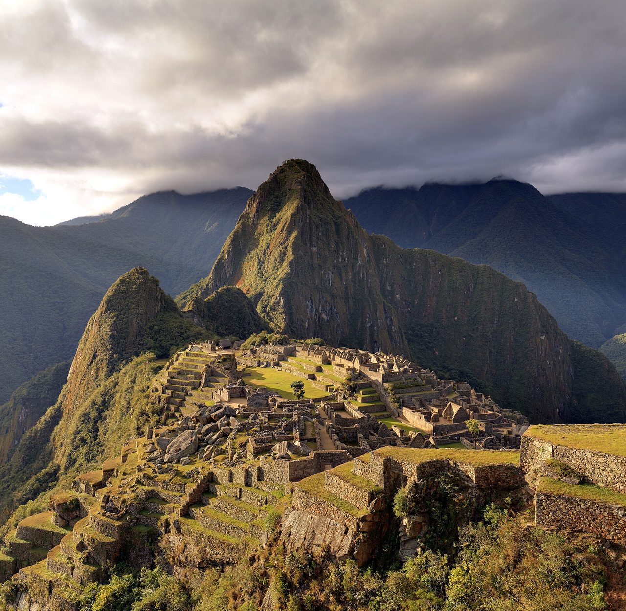
What it is: a 15th-century Inca royal estate on a ridge at 2,430 m, surrounded by a 32,000-hectare sanctuary of cloud forest. Why it was listed: for the architecture and the way it is fitted to the landscape, and separately for the ecology of the sanctuary around it, which is why it is mixed rather than purely cultural. Spectacled bears live in there. Most visitors never think about the natural half of the citation at all, and my full guide to the citadel goes into what the estate was actually for.
Getting there: train from Ollantaytambo or Poroy to Aguas Calientes, then a shuttle bus up the switchbacks, or four days on foot. There is no road to the town. I have written separately about the different ways into the sanctuary and about what the train journey is actually like, because the logistics are the part people get wrong.
Practicalities: entry is capped, currently 4,500 people a day in the normal season and up to 5,600 on designated high-season dates, which in 2026 means 1 January, 2–5 April, 19 June to 2 November, and 30–31 December. You buy a specific circuit with a specific entry time and you get between two and a half and four hours inside. Foreign adult entry is S/163 for the standard circuits and S/211 for the routes that include Huayna Picchu or Machu Picchu Mountain, after a SERNANP conservation surcharge was added on 1 May 2026. If a site quotes you S/152 it has not updated since April. Prices and circuit rules move more than you would like, so check the official portal before you commit. The mechanics of which circuit to buy and when they release and the question of whether the extra peak is worth the surcharge deserve their own reading.
How long: one full day if you sleep in the town below the ruins, two if you want a sunrise slot and a second circuit. It can be done as a single very long day from Cusco but I would not, and I have set out how much time the place actually rewards elsewhere.
City of Cuzco (cultural, 1983)
What it is: the Inca capital, with a Spanish colonial city built directly on top of it, at 3,399 m. Why it was listed: precisely for that layering. Walk down Calle Loreto and you have Inca ashlar masonry at knee height and a colonial arcade above it. The Qorikancha, where a Dominican convent sits on the foundations of the Inca sun temple, is the single clearest demonstration of the point UNESCO was making.
Practicalities: the site is a living city of 400,000 people, so there is no entrance fee to the property itself. What you pay for is the individual buildings. The Boleto Turistico General runs S/130 for foreign adults, covers sixteen sites including Sacsayhuaman and several in the valley, and is valid ten days. Partial circuits are S/70. It is compulsory for the ruins around the city whether you want the other fourteen sites or not, which is mildly annoying and worth budgeting for.
How long: two to three days, and the first of them should be spent doing very little because of the altitude. There is a great deal more to fill your time with in and around Cusco than the World Heritage citation implies, and the Sacred Valley below the city is where I would put a spare day.
The coast: Lima, Caral, Chankillo, Chan Chan and Nasca
Five of the thirteen are on or near the coastal desert strip, which makes them far easier to combine than people assume. Four of the five are within a day’s drive of the Panamericana Norte or Sur.
Historic Centre of Lima (cultural, 1988, extended 1991)
What it is: the colonial core of the capital, inscribed for its Spanish Baroque architecture and its role as the administrative centre of Spanish South America. The 1991 extension added the convent of San Francisco. Why it was listed: Lima was the seat of the Viceroyalty of Peru, and the churches, balconies and the Plaza Mayor are the physical record of that.
Practicalities: the streets are free. San Francisco, with the catacombs underneath holding an estimated 25,000 sets of remains, is the one interior I would not skip; entry is a few soles, it is guided only, tours run roughly 09:00 to 17:30 and take about an hour. The Casa de Aliaga and Torre Tagle palace are the other two worth the time. Be sensible about which streets you wander after dark; the historic centre is not the same proposition as Miraflores.
How long: half a day is enough for the World Heritage part. You will want longer in the city for other reasons, and I have gone through what is genuinely worth doing in Lima separately, along with the case that Peruvian cooking is the real reason to give the capital two nights instead of one.
Sacred City of Caral-Supe (cultural, 2009)
This is the one I would push hardest. Caral is roughly 5,000 years old. It is contemporary with the Egyptian pyramids and predates the Olmec by around 1,500 years, which makes it the oldest urban centre in the Americas by a wide margin. Six platform mounds, a sunken circular plaza, residential quarters, and no defensive walls or weapons anywhere in 66 hectares.
Why it was listed: for being the earliest evidence of complex urban society in the Americas and for how completely it survived, untouched by later building.
Getting there: about 180 km north of Lima, then inland along the Supe valley on a road that is worse than the distance suggests. Realistically three and a half to four hours each way. Public transport is possible — bus from Plaza Norte to Supe or Barranca, then a taxi — but it eats the day. Most people take an organised day trip.
Practicalities: entry is around S/11 plus a small mandatory guide fee, cash in soles only, open roughly 09:00 to 16:00 with the last guided walk starting mid-afternoon. Take a hat. There is no shade at all.
How long: two to three hours on site, a full day door to door from Lima. Around 25,000 people a year go. On the morning I was there we were one of two groups on the whole site. For a property of this significance that is close to absurd, and if you have a spare day at the start of your trip while you are adjusting, this is a far better use of it than another Miraflores brunch.
Chankillo Archaeoastronomical Complex (cultural, 2021)
What it is: Peru’s newest inscription and the only one on this list that is genuinely obscure. Thirteen cuboidal stone towers strung along a ridge in the Casma valley, built around 250–200 BC, flanked by an observation point at each end. Watch the sun rise from the western point across the year and it climbs the tower line, tower by tower, from one solstice to the other. It is a calendar you read by standing in the right spot.
Why it was listed: as the earliest known solar observatory in the Americas, and as an unusually complete example of ancient astronomical practice fixed into a landscape.
Getting there: Casma, in Ancash, about 370 km north of Lima on the Panamericana. Buses run; the site itself is a taxi or tour from town and is not signposted in any way you would trust. Go in the morning, before the coastal wind gets up and before the light flattens.
How long: half a day on site, a full day from Casma. If you are driving the north coast it slots in easily between Lima and Trujillo. If you are not, it is a long way to go for thirteen stumpy towers, and I would say that honestly rather than pretend otherwise. It is spectacular if you care about how ancient people organised time. It is a pile of rocks if you do not.
Chan Chan Archaeological Zone (cultural, 1986, In Danger since 1986)
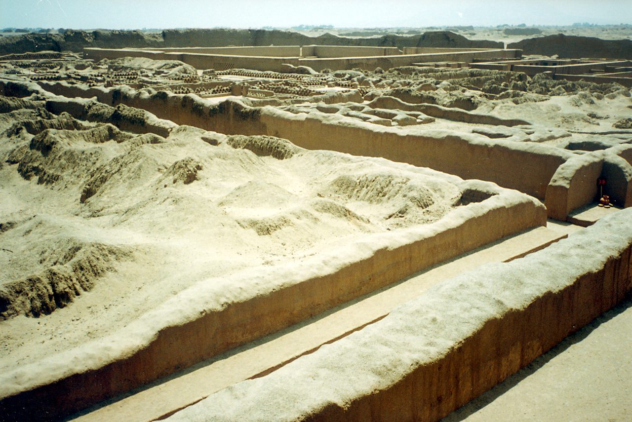
What it is: the largest earthen city in the Americas and the capital of the Chimu kingdom, which ran the north coast until the Inca absorbed it around 1470. Roughly 20 km², nine walled ciudadelas, tens of thousands of residents at its height.
Why it was listed: for the scale and the planning, and for the friezes — wall after wall of stylised fish, seabirds, and net patterns pressed into adobe. It is the ocean rendered as architecture, which for a desert city says a great deal.
Practicalities: one palace complex, Nik An, is open to visitors. Entry is about S/11 for adults on a combined ticket that also covers the site museum, Huaca Esmeralda and Huaca Arco Iris, and it stays valid for two days. Open roughly 09:00 to 16:30. Bring water; there is no shade here either.
Getting there: 5 km from Trujillo, on the Huanchaco road, so a taxi or a colectivo. Trujillo is a one-hour flight or an overnight bus from Lima.
How long: two to three hours at Nik An, more if you add the Huacas del Sol y de la Luna nearby, which are not UNESCO-listed and are in some ways more visually striking. A full day covers both comfortably. Chan Chan is badly underrated and it is the anchor of any trip through the northern half of the country, which sees a fraction of the traffic the south does.
Lines and Geoglyphs of Nasca and Palpa (cultural, 1994)
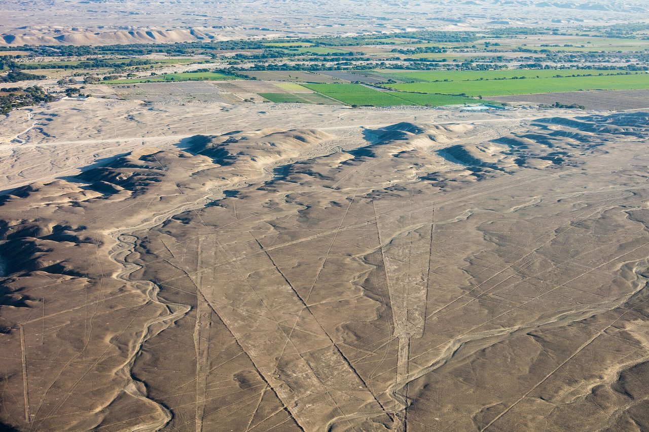
What it is: hundreds of geoglyphs cut into 450 km² of desert pampa between roughly 500 BC and AD 500, by scraping away the oxidised surface stones to expose paler ground underneath. Note the official name: it covers Palpa as well as Nasca, and it was renamed from the older “Nazca and Pampas de Jumana” formulation. Half the blogs still use the old one.
Why it was listed: for the scale, the precision achieved without any aerial vantage point, and the ritual and hydrological readings archaeologists have since built on them.
Practicalities: the honest version is that the roadside mirador shows you two and a half figures badly, and the flight is the experience. A 30 to 35 minute overflight from Nasca aerodrome runs roughly US$85 to US$150 depending on operator and season, plus about S/30 airport tax and S/47 site fee, both in cash on the day. Flights from Pisco or Ica cost two to three times that because of the transit time. Fly in the morning; afternoon thermals turn a small plane into a fairground ride and a meaningful number of passengers are sick. Skip breakfast.
How long: the flight is 35 minutes, the whole business is half a day with waiting. Nasca sits on the run down the southern coast between Paracas and Arequipa, which is the natural place to fit it.
The mountains: Arequipa, Chavin and Huascaran
Historical Centre of the City of Arequipa (cultural, 2000)
What it is: 49 blocks of a colonial city built almost entirely from sillar, the white volcanic ignimbrite quarried from the volcanoes above it. At 2,335 m, with the cone of El Misti visible from half the streets in town.
Why it was listed: as an example of a colonial settlement whose architecture is a genuine fusion — European forms executed by indigenous and mestizo craftsmen in a local material, producing something that does not look like Spain and does not look like anywhere else in Peru either.
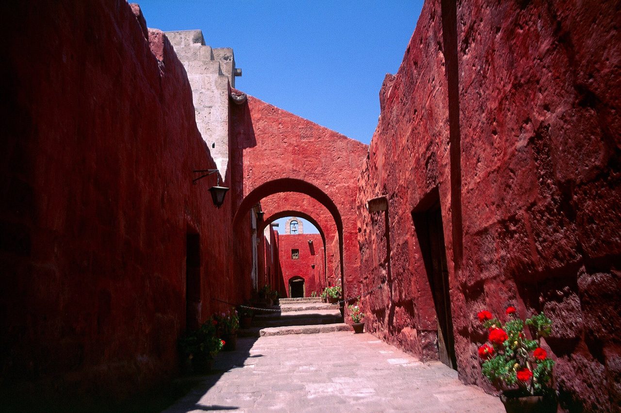
Practicalities: free to walk. The Santa Catalina monastery, a walled city-within-a-city of ochre and cobalt lanes, is the one paid entry that justifies itself; expect around S/50, open daily to early evening with later hours a couple of nights a week. The Plaza de Armas and the Jesuit church of La Compania are free.
How long: two days for the centre, three if you add Colca. It is also the best-fed city in Peru outside Lima, and I have set out the case in my longer guide to Arequipa.
Chavin, Archaeological Site (cultural, 1985)
What it is: a ceremonial centre in a high valley at 3,180 m, built and rebuilt from around 1200 BC, and the type site of the Chavin horizon that spread its iconography across much of what is now Peru. The reason to go is underground: a network of stone galleries in near-total darkness, at the centre of which stands the Lanzon, a four-and-a-half-metre granite monolith carved with a fanged figure, still in its original position.
Why it was listed: for the architecture and for its influence, as one of the earliest and most important religious centres in the Andes.
Getting there: a full-day trip from Huaraz over the Cahuish pass at 4,500 m, roughly 110 km on a road that takes three hours in each direction. Tours leave around 09:00 and get back after dark. There is no comfortable way to shortcut it.
Practicalities: entry is modest, around S/15 to S/20, with the excellent Museo Nacional de Chavin nearby charging separately. Standing in the gallery with the Lanzon, with the acoustics doing what they were designed to do, is one of the three or four most affecting things I have done in Peru. It is also freezing.
How long: two hours on site, ten to twelve hours door to door. Do not attempt it on your first day in Huaraz.
Huascaran National Park (natural, 1985)
What it is: 340,000 hectares of the Cordillera Blanca, the highest tropical mountain range on earth, containing 27 peaks above 6,000 m. Huascaran Sur, at 6,768 m, is the highest mountain in Peru.
Why it was listed: for the glacial landscape, the turquoise lakes, and the endemic flora, including the Puya raimondii, a bromeliad that grows for eighty years, flowers once with a ten-metre spike, and dies.
Practicalities: SERNANP charges by duration rather than by visit. Expect around S/30 for a single day, S/60 for two to three days, and S/150 for a longer permit covering up to a month. Buy at the control posts, through your operator, or at the SERNANP office in Huaraz, and bring cash. The classic short outing is Laguna 69, a four-hour round-trip walk topping out near 4,600 m; the classic multi-day is the Santa Cruz trek, four days over a 4,750 m pass.
How long: two days if you only want a day hike and Laguna Paron. Five or six if you want a trek. Huaraz is eight hours by bus from Lima and there is no useful commercial flight, which is the main reason the Cordillera Blanca stays quieter than it deserves. Sort out your acclimatisation before you go; the general practicalities of travelling in Peru matter more here than anywhere else on this list.
The three difficult ones: Manu, Rio Abiseo and the Qhapaq Nan
Here is where the copy-paste articles fall apart. Two of these are not straightforwardly visitable and one of them is not really a place at all.
Manu National Park (natural, 1987)
What it is: about 1.7 million hectares dropping from 4,000 m of Andean puna through cloud forest to lowland Amazon at 300 m. That altitudinal range is the whole point: more than a thousand bird species, roughly a tenth of the world’s total, plus thirteen primate species, giant otters and jaguar.
Why it was listed: for biodiversity, and specifically for the intact gradient from highland to lowland, which almost nowhere else still has.
The honest access position: Manu is zoned, and the zoning is the single most important practical fact about it. The Cultural Zone, on the upper edge, is open and you can travel there independently. The Reserved Zone, which is where the oxbow lakes and the good wildlife are, requires a permit and can only be entered with an authorised operator. The core, variously called the Intangible or Strictly Protected Zone, is closed to everyone but researchers and the uncontacted and recently contacted peoples who live there. If a tour is sold to you as “Manu National Park” at a suspiciously low price, check which zone it enters; a lot of cheap Manu trips never leave the Cultural Zone.
Practicalities: Reserved Zone trips run five to eight days and typically US$900 to US$1,400 per person, more for the better lodges. Access is overland from Cusco, roughly ten hours to the river, then boat. Book well ahead in the dry season. If what you want is Amazon wildlife rather than a UNESCO tick, Tambopata is cheaper, quicker and nearly as good, and I compare the options in my guide to the Peruvian Amazon.
Rio Abiseo National Park (mixed, 1990, extended 1992)
Say this plainly, because the tour-operator blogs will not: you cannot visit Rio Abiseo. The interior has been closed to tourism since 1986. Not restricted, not permit-heavy in the way Manu is. Closed.
What it is: 274,000 hectares of montane cloud forest on the eastern Andean slope in San Martin, created in 1983 to protect the yellow-tailed woolly monkey, a species that had been presumed extinct for most of the twentieth century. It was inscribed as a natural property in 1990, then extended in 1992 to cover its cultural value: more than thirty pre-Columbian archaeological sites inside the park, including Gran Pajaten, a circular-terraced complex with mosaic stonework that specialists rank alongside the great sites of the Andes.
Why you cannot go: the archaeology is fragile, the forest floor is fragile, and access requires days of walking in terrain with no infrastructure. Peru’s park service issues permits for scientific and conservation work, occasionally for documented cultural purposes, and the process is slow and not aimed at tourists. Operators in San Martin will sometimes talk about arranging expeditions in the low-water months. Treat that with scepticism. Gran Pajaten in particular is off limits, and going anyway would be both illegal and genuinely damaging.
What to do instead: if the appeal is remote cloud-forest archaeology, the Chachapoyas region a few hours north gives you Kuelap, the Karajia sarcophagi and Gocta falls, all legally accessible and all currently on Peru’s Tentative List rather than the main one. It is the honest substitute, and it is a genuinely good trip.
Qhapaq Nan, Andean Road System (cultural, 2014)
This is the one that confuses people, and fair enough. Qhapaq Nan is not a site. It is roughly 30,000 km of Inca road running through six countries — Peru, Ecuador, Colombia, Bolivia, Chile and Argentina — of which the inscribed property is a selected set of segments, tambos, bridges and staircases. Peru alone contains fifty-four of the component locations.
Why it was listed: as an engineering and administrative achievement, the nervous system of an empire that ran from southern Colombia to central Chile without wheels, without a writing system, and across some of the most difficult terrain on the planet.
What “visiting” means in practice: you walk a segment. That is the whole answer. There is no gate and no ticket for Qhapaq Nan as such; there are permits and fees for the particular stretch you choose. The most famous stretch by a distance is the four-day Inca Trail from Km 82 to Machu Picchu, which is a component of the property and is capped at 500 permits a day including staff, meaning perhaps 200 trekkers. Permits sell out months ahead and cannot be transferred. Other accessible segments include the stretch above Huanuco Pampa, the Xauxa–Pachacamac route, and short walkable sections in the Sacred Valley and around Ollantaytambo that you can do in an afternoon for nothing.
The Q’eswachaka rope bridge over the Apurimac, rebuilt by hand every June by four communities using twisted ichu grass, is the other component most travellers can reach: a long day trip from Cusco, and the only Inca suspension bridge still maintained by the original method.
How long: an afternoon for a Sacred Valley section, four days for the Inca Trail, or a couple of weeks if you are serious. If you walk the classic trail you have visited two World Heritage properties at once, which is the neatest efficiency on this whole list.
Which Peru UNESCO sites can you actually string together on one trip
This is the part the competing articles get lazy about. They give you a list of place names and call it an itinerary. Here are three routes that work, with honest counts and the compromises stated.
Route 1: eight days, four sites, the one most people do
Lima (Historic Centre) → Cusco (City of Cuzco) → Sacred Valley → Machu Picchu, with a Sacred Valley walk on a Qhapaq Nan segment thrown in for a fourth. That is also close to the standard first-trip route through the country’s headline regions.
Two nights Lima, three in Cusco with the first spent horizontal, a night in the valley, a night at Aguas Calientes, out. This is the standard route for a reason: the flights are cheap and frequent, the altitude sequencing works, and you can build it in a fortnight of planning. It gives you four of the thirteen without any of the hard travel. Most versions of a first Peru itinerary are some variation on this.
Route 2: two weeks, eight sites, coast then Andes
Lima (2 nights: Historic Centre, Caral day trip) → Paracas/Nasca (2 nights: geoglyph flight) → Arequipa (3 nights: Historical Centre, Colca) → Cusco (3 nights) → Sacred Valley and Machu Picchu (3 nights) → out.
Six clean sites, plus Qhapaq Nan if you walk a segment, plus Machu Picchu’s mixed status if you want to count that twice. The overnight bus from Nasca to Arequipa is nine hours and the flat-bed services are genuinely comfortable, which is the trick that makes this fit in fourteen days. It costs less than people expect; I break the numbers down in what a Peru trip really costs. If you would rather fly the long legs, the domestic transport options are worth reading first, because a couple of the connections only make sense one way round.
Route 3: three weeks, ten or eleven sites, if you are stubborn
Lima → Caral → Casma (Chankillo) → Huaraz (Huascaran, Chavin) → Trujillo (Chan Chan) → fly back to Lima → Nasca → Arequipa → Cusco → Machu Picchu → optional Manu.
This gets you eleven of the thirteen if you include a Qhapaq Nan segment and skip Manu, or twelve if you add a Manu Reserved Zone trip on the end and are prepared to give it a week. It is a real trip and I would happily do it again, but be clear about what it involves: the northern half is long-distance buses on the Panamericana, several 4,000 m-plus passes, and a level of logistical friction the south does not have. Do the north first, while you are fresh. Do not try to compress it into two weeks. And accept that Rio Abiseo is not going on your list no matter how the route is drawn.
What you cannot realistically fit in
Nobody sees all thirteen on one trip. Rio Abiseo rules it out on its own. Manu adds a minimum of five days and sits at the end of a ten-hour road out of Cusco in the opposite direction from everything else. Chankillo and Chavin are only sensible if you are already committed to the north-central corridor. Anyone advertising a fortnight that covers everything is either counting a photograph of an Inca road as Qhapaq Nan or has not looked at a map. My own view: get eight of the thirteen in a fortnight, do it well, and go back for the north later. Choosing which towns to base yourself in matters more than squeezing in another site.
What it all costs to get in
Entry fees in Peru are low by international standards for everything except Machu Picchu. The expensive part is transport, not tickets. All figures below are foreign adult rates in 2026 and should be treated as indicative; sites revise them without much notice.
| Site | Entry (foreign adult) | Notes |
|---|---|---|
| Machu Picchu | S/163 standard; S/211 with Huayna Picchu or Machu Picchu Mountain | Timed circuits; buy weeks ahead; check the official portal for changes |
| Cusco (Boleto Turistico) | S/130 full, 10 days, 16 sites; S/70 partial | City streets are free; the ticket covers the ruins |
| Historic Centre of Lima | Free to walk; a few soles for San Francisco | Catacombs are guided-only |
| Caral | ~S/11 plus small guide fee | Cash in soles only; guiding is compulsory |
| Chan Chan | ~S/11 combined, valid 2 days | Includes site museum, Huaca Esmeralda, Huaca Arco Iris |
| Chavin | ~S/15–20, museum extra | Guides available on site for around S/70 per group |
| Chankillo | Nominal | Transport from Casma is the real cost |
| Nasca Lines | US$85–150 flight + ~S/30 tax + ~S/47 fee | Cash on the day for the taxes; morning flights only |
| Arequipa | Free to walk; ~S/50 for Santa Catalina | Santa Catalina is worth it |
| Huascaran NP | S/30 one day, S/60 two–three days, S/150 longer | SERNANP; cash; buy in Huaraz or at control posts |
| Manu (Reserved Zone) | US$900–1,400 for a 5–8 day trip | Authorised operators only; permit included in the price |
| Qhapaq Nan | Free for open segments; Inca Trail from ~US$700 | Inca Trail permits capped and non-transferable |
| Rio Abiseo | Not applicable | Closed to tourism |
When to go
Peru is really three climates and the World Heritage sites are spread across all of them, so there is no single perfect month. The Andean sites — Cusco, Machu Picchu, Chavin, Huascaran, the road segments — are at their best from May to September, dry and cold at night. The coastal sites are the inverse: Lima, Caral, Chankillo and Chan Chan sit under a grey marine inversion from roughly June to November and are sunniest from December to April. The Amazon side, meaning Manu, is most practical from May to October when the rivers behave.
If you are combining coast and mountains, the compromise months are April–May and September–October. You get shoulder-season pricing, thinner crowds at Machu Picchu, and a decent chance of sun on the coast. June to August is the safest weather in the highlands and the most expensive and crowded everywhere. I go into the trade-offs by region in the seasonal breakdown for Peru, and specifically for the citadel in the month-by-month view of Machu Picchu. One hard constraint: the Inca Trail closes for maintenance every February, and February is also the wettest month in Cusco.
Common questions about Peru’s World Heritage list
How many UNESCO World Heritage Sites does Peru have?
Thirteen, as of 2026. Nine cultural, two natural and two mixed. Anything claiming twelve was written before the 2021 inscription of Chankillo and has not been updated. Peru also has twenty-four properties on its Tentative List, which is the waiting room, not the list.
Which is Peru’s newest UNESCO site, and which is the oldest inscription?
Chankillo, inscribed in 2021, is the newest. The oldest inscriptions are the City of Cuzco and the Historic Sanctuary of Machu Picchu, both added in 1983 at the Committee session in Florence, the year after Peru ratified the convention. The oldest site by age is Caral, at roughly five thousand years, which was not inscribed until 2009.
Can you visit all thirteen?
No. Rio Abiseo has been closed to tourism since 1986 and permits are issued for research, not sightseeing. Manu’s core zone is closed to everyone, and its Reserved Zone requires a permit and an authorised operator. Qhapaq Nan cannot be “visited” in full because it is 30,000 km long. Eleven is the realistic ceiling for a determined traveller, and eight is a very good result for a fortnight.
Which UNESCO site is closest to Lima?
The Historic Centre of Lima is in the city. After that, Caral, about four hours north by road and comfortably a day trip. Chankillo is next, five to six hours north. If you have a single spare day in Lima and any interest in archaeology, Caral is the answer.
Is Chan Chan still on the List of World Heritage in Danger?
Yes. It was inscribed and placed on the danger list in the same year, 1986, because of erosion from El Nino rains, looting and encroachment. A conservation master plan running to 2031 is aimed at getting it removed, and the state of conservation is reviewed regularly, but it remains on the list in 2026. This does not stop you visiting and you should.
Why is Machu Picchu a mixed site rather than a cultural one?
Because the inscribed property is the Historic Sanctuary, not just the ruins. It covers around 32,000 hectares of cloud forest with its own conservation value, including spectacled bears and a long list of orchids, and it met natural criteria as well as cultural ones. Rio Abiseo is mixed for the same structural reason: forest plus archaeology. Worth knowing if you want the background to how the site was built and rediscovered, which is more contested than the plaques suggest.
Do you need a guide?
At Caral, yes, it is compulsory and included in the price. At Machu Picchu a guide is required for first entry on most circuits in practice, and the rules have tightened. At Chavin I would strongly recommend one; the galleries make no sense unguided. At Chan Chan a guide is optional but the friezes need explaining. Lima and Arequipa you can walk yourself with a decent map. Huascaran depends entirely on what you are doing.
Which of the thirteen would I skip?
If you are short on time and not an archaeology specialist, the Historic Centre of Lima is the one I would give the least attention to, not because it is bad but because you will pass through it anyway and half a morning covers it. Chankillo is the one I would skip if you are not already going north; the effort-to-payoff ratio is poor unless the astronomy grabs you. And I would not build a trip around whether Machu Picchu justifies the crowds without reading the honest version first. The ones I would fight to keep in: Caral, Chavin and Chan Chan, all three of which are better than their visitor numbers imply and all three of which sit outside the standard circuit of the country’s headline attractions.
What should I wear at these sites?
The coastal sites are hot, exposed desert with no shade at all: hat, sunscreen, long sleeves. The Andean sites are cold in shadow and fierce in sun on the same afternoon, so layers and a windproof shell. Chavin’s galleries are damp and cold year round. Sturdy shoes everywhere; the ground at Chan Chan and Caral is uneven sand and rubble. I have gone through the specifics for the citadel in the packing notes for Machu Picchu, and most of it transfers.