Northern Peru & the Beaches: The Complete Guide
Warm-water beaches, Kuelap, Chan Chan, Gocta and the Cordillera Blanca: how to plan northern Peru properly, from someone who keeps going back.
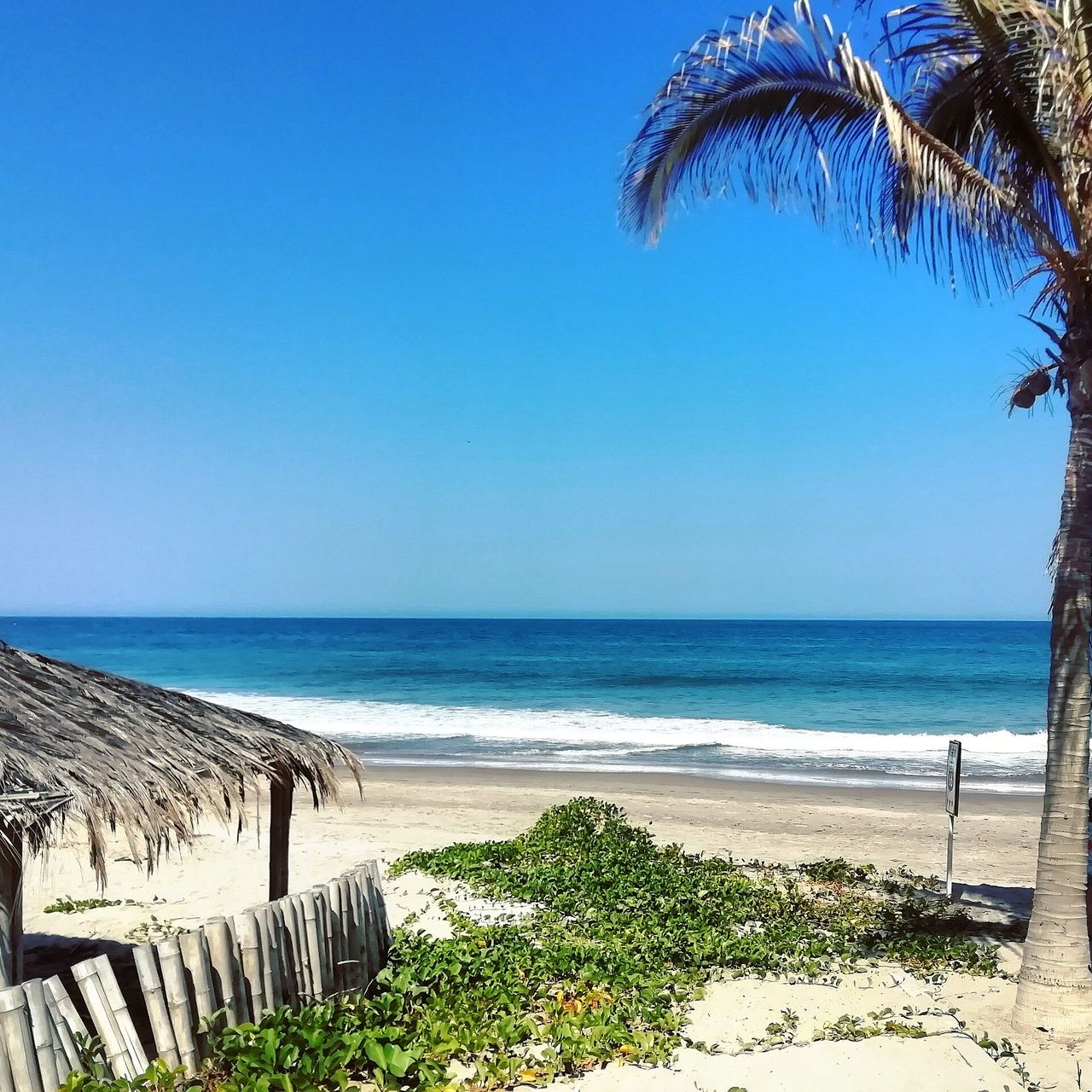
Northern Peru is the half of the country most travelers never see, and after three trips up there I’ve stopped trying to understand why. Everyone funnels south to Machu Picchu — which is fair, it’s Machu Picchu — while the north sits there with warm-water beaches, the second-highest tropical mountain range on earth, a cloud-forest citadel older than the Incas, and ceviche that ruined every other ceviche for me. You can walk the largest adobe city in the Americas at 10am and have an entire pre-Inca pyramid complex to yourself by 2pm. No timed tickets. No circuits. Almost no tour buses.
The short answer: northern Peru combines Pacific surf beaches (Mancora, Punta Sal, Huanchaco), world-class pre-Inca archaeology (Chan Chan, Sipan, Kuelap), and serious trekking (Huaraz and the Cordillera Blanca) with a fraction of the south’s crowds. You need 10 days minimum, ideally two to three weeks. Fly between hubs; the distances are huge.
Northern Peru at a glance
The north isn’t one destination — it’s four very different ones stitched together by long bus rides and short flights. The coast is desert, beach towns and ancient mud cities. The Cordillera Blanca around Huaraz is glacier country. Chachapoyas is cloud forest and lost-civilization territory. And the far northeast tips into the Amazon basin around Tarapoto and Iquitos, which I cover separately in my Peruvian Amazon guide. Here’s how the pieces compare before we go region by region.
| Region | Base town | Why you go | Days needed | Getting there |
|---|---|---|---|---|
| Far north beaches | Mancora or Punta Sal | Year-round sun, warm water, surf, ceviche | 3–5 | Fly Lima→Talara or Piura, then 1–2 hr drive |
| Moche coast | Trujillo / Huanchaco | Chan Chan, Huacas del Sol y de la Luna, El Brujo, surf history | 2–3 | Fly or 8–9 hr bus from Lima |
| Lambayeque valley | Chiclayo | Lord of Sipan, Tucume pyramids, best museums in Peru | 1–2 | Fly from Lima, or 3–4 hr bus from Trujillo |
| Chachapoyas cloud forest | Chachapoyas | Kuelap fortress, Gocta waterfall, sarcophagi of Karajia | 3–4 | Fly Lima→Jaen, then 3–4 hr drive |
| Cordillera Blanca | Huaraz | Laguna 69, Santa Cruz trek, 6,000 m peaks | 4–7 | 8 hr bus or 1 hr flight from Lima |
| Cajamarca highlands | Cajamarca | Inca history, thermal baths, dairy country, carnival | 2 | Fly from Lima, or bus from the coast |
If you only take one thing from this guide, make it this: don’t try to do all of it in one go unless you have three weeks. The map compresses badly. Trujillo to Chachapoyas alone is a 12-hour night bus, and Huaraz sits on a completely different axis from everything else. Pick two regions, three at most, and do them properly. I’ve laid out exact routes in the northern Peru itinerary section below and in my full Peru itinerary guide.
Why northern Peru is the best Peru off the beaten path
Here’s the honest pitch. Peru gets around three million visitors in a normal year, and the overwhelming majority of them trace the same line: Lima, Cusco, the Sacred Valley, Machu Picchu, maybe Arequipa and Lake Titicaca if they have time. The north gets the leftovers — and the leftovers are some of the most significant archaeology in the Americas.
This is where the continent’s oldest city rose at Caral 5,000 years ago. Where the Moche built adobe pyramids and buried the Lord of Sipan with more gold than Tutankhamun’s tomb. Where the Chimu raised Chan Chan, a mud-brick capital that once held 50,000 people. Where the Chachapoya — the “cloud warriors” the Incas never fully conquered — walled off an entire mountaintop at Kuelap centuries before Machu Picchu existed. When people ask me where to find Peru off the beaten path, I don’t send them to a hidden corner of the Sacred Valley. I send them north.
The trade-off is real, and I won’t pretend otherwise. Infrastructure is thinner. Buses are long. English is rarer. The food, weirdly, is better — Chiclayo and Trujillo locals will fight Lima over this and they have a case. If you want polished, the south has polish. If you want the version of Peru where a site guard walks you around personally because you’re the only visitor that hour, northern Peru travel is your answer.
The northern beaches: Peru’s only warm-water coast
Most of Peru’s coastline is a cold-water desert thanks to the Humboldt Current — swimmable in summer if you’re brave, wetsuit territory the rest of the year. Then, just past Piura, the Humboldt bends west, the equatorial current takes over, and the water jumps ten degrees. The far north — the Piura and Tumbes coast — is the only stretch of Peru where you can swim comfortably in board shorts in July. This is where Peruvians themselves go on beach holidays, and it’s the stretch I cover town by town in my guide to the best beaches in Peru.
Mancora: the party-and-surf capital
Mancora is the name everyone knows, and it earns the reputation in both directions. The good: a long sandy beach, a consistent left point that’s one of the friendliest places in South America to learn to surf, water that hovers around 24°C year-round, beach bars, real espresso, and the best cheap ceviche of my life from a plastic-chair place two blocks off the main drag. The bad: the Panamericana runs straight through town, mototaxis buzz like hornets, and on holiday weekends the party crowd owns the night. I’ve stayed in a $12 hostel dorm and a $150 beachfront bungalow here and enjoyed both for completely different reasons. My full Mancora Peru guide breaks down exactly where to stay and eat, but the short version: stay south of the center at Las Pocitas if you want quiet, in the center if you want the scene.
Punta Sal, Vichayito and the quiet alternatives
Everything I love about the far north that isn’t nightlife happens in the satellite beaches. Punta Sal, 25 minutes north, is a long protected bay with calm, genuinely warm water — the swimming beach of the entire coast, and where Peruvian families book resorts. Vichayito, just south of Mancora, is palm trees, kitesurfers and barefoot lodges with no town at all. Los Organos is the local fishing town that surfers quietly prefer now that Mancora got loud — and from July to October you can watch humpback whales breach from the pier. Zorritos, further into Tumbes, has hot springs and almost zero foreign tourists. And tiny Cabo Blanco is a pilgrimage: Hemingway came for the black marlin in the 1950s, and the pipe-like left that breaks here is the most famous expert wave in the country.
| Beach | Vibe | Swimming | Surf level | Stay here if |
|---|---|---|---|---|
| Mancora | Backpacker-party, lively | Good | Beginner-friendly point | You want bars, lessons, options |
| Las Pocitas | Boutique, mellow | Good | Watch, don’t surf | You want Mancora food without noise |
| Vichayito | Barefoot-luxury, kites | Good | Kitesurf heaven | Honeymoon or remote-work week |
| Punta Sal | Family resort bay | Best on the coast | Minimal | You’re here to swim and do nothing |
| Los Organos | Local town, low-key | Good | Intermediate point | Whale season (Jul–Oct) |
| Cabo Blanco | Fishing village, legend | Fine | Experts only | You surf seriously or love Hemingway |
| Huanchaco (Trujillo) | Surf history, ruins access | Cool water | All levels | You’re combining waves with Chan Chan |
Getting here is easier than the map suggests: fly Lima to Talara (the closest airport, about an hour from Mancora), Piura (2.5 hours) or Tumbes (1.5 hours from Punta Sal). Buses from Lima exist but it’s an 18–20 hour haul — I’ve done it once on a 160-degree reclining seat and that was enough. More transport detail in my getting around Peru guide.
When to hit the peru beaches up north
The far north markets itself as “300 days of sunshine” and for once the marketing is roughly true. December to March is hottest and sunniest — proper tropical heat, biggest surf swells, high-season prices around Christmas and Easter. April to November stays warm and dry with cooler nights and smaller, cleaner waves. The only wrinkle is El Nino years, which can bring heavy rain to this coast; outside of those, there’s no bad month. Whale-watching from Los Organos and Punta Sal runs July through October. I go in shoulder season — May or October — when the water’s still 24°C and half the lodges are empty. For the country-wide picture, see my best time to visit Peru guide.
Trujillo and the Moche route: pyramids, friezes and reed boats
Trujillo is northern Peru’s biggest city and the anchor of what archaeologists call the Moche route — a string of sites along the coast that, taken together, rewrite what you think you know about ancient Peru. The Incas were the final chapter of Andean civilization, not the whole book. The Moche were building monumental pyramids here while Rome was still an empire, and the Chimu who followed them ran a coastal kingdom the Incas only absorbed a few decades before the Spanish arrived. I’ve written a dedicated Trujillo and Chan Chan guide, but here’s what matters.
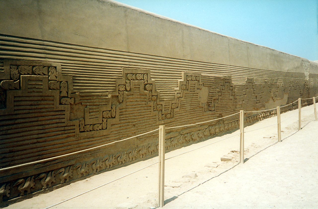
Chan Chan: the largest adobe city in the Americas
Chan Chan covers about 20 square kilometers between Trujillo and the sea — a UNESCO World Heritage city of mud brick that held an estimated 40,000–60,000 people at its peak around 1400 AD. What you visit today is mostly the restored Nik An palace compound, where corridors open onto ceremonial plazas walled with friezes of pelicans, fish and the crosshatch patterns of fishing nets. The Chimu worshipped the sea, and the whole city reads like a love letter to it. Go early, hire a guide at the entrance (around S/60, worth every sol), and don’t skip the site museum. The same ticket covers Huaca Arco Iris and Huaca Esmeralda in town, valid for two days.
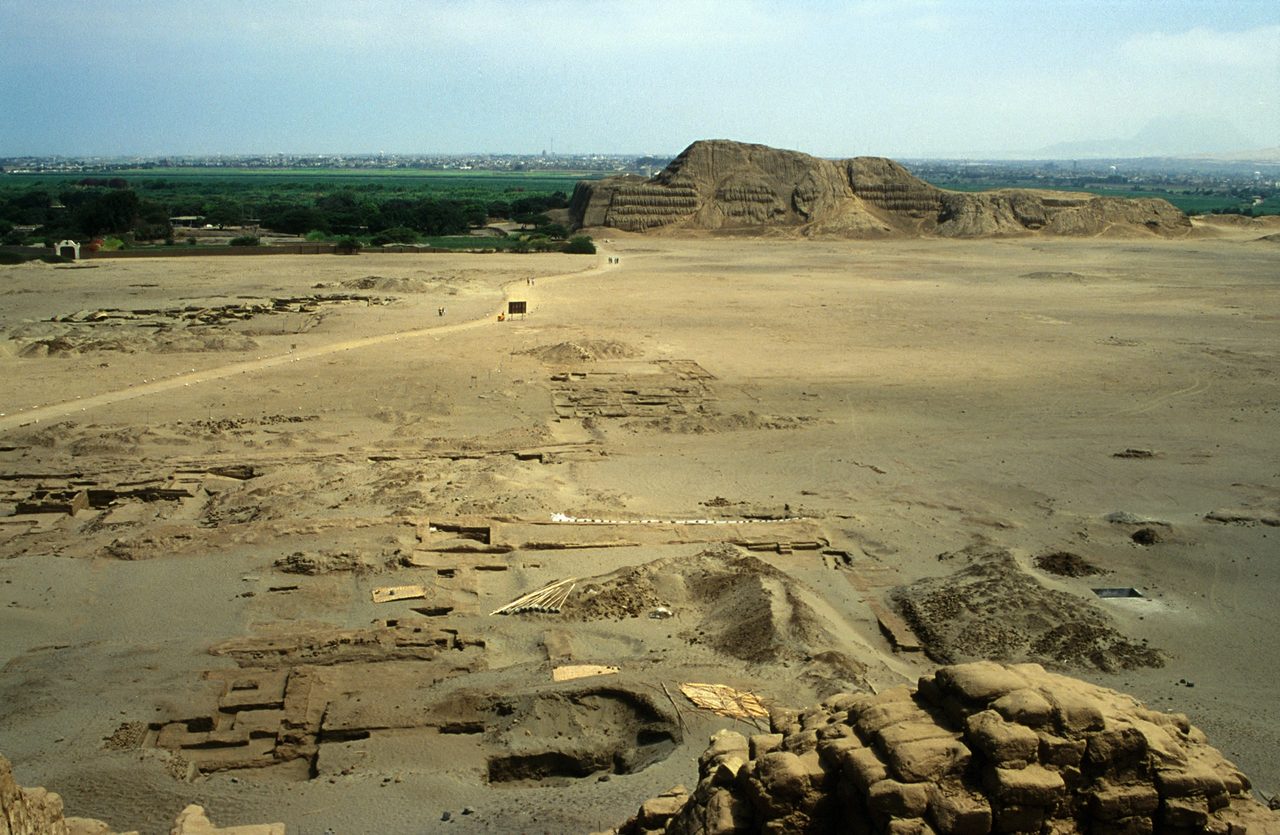
Huacas del Sol y de la Luna: the painted mountain
Across the valley, the Huaca de la Luna is the site that genuinely stunned me. From outside it’s a weathered adobe mass at the foot of Cerro Blanco. Inside, because the Moche ritually buried each construction phase under the next, archaeologists keep peeling back layers to reveal seven centuries of friezes still carrying original pigment — red, yellow, black and white murals of the fanged god Ai Apaec stacked six tiers high. The neighboring Huaca del Sol, once the largest adobe structure in the Americas, looms unexcavated in the distance; the Spanish diverted a river through it hunting for gold, which tells you everything about the colonial period. The attached Museo Huacas de Moche is excellent. Half a day covers it; combine with Chan Chan for one very full, very good day.
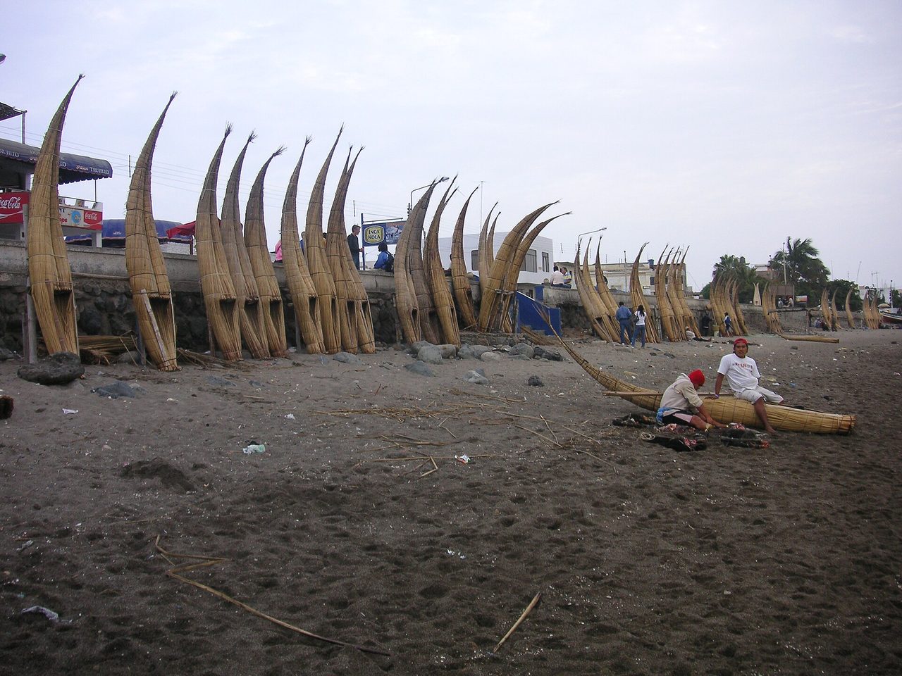
Huanchaco: 3,000 years of surfing
Fifteen minutes from Trujillo, Huanchaco is the beach town where fishermen still paddle out on caballitos de totora — reed boats whose design predates the Incas by millennia. Watching them ride whitewater home at sunset, it’s hard to argue with the locals’ claim that this is where wave-riding was born. Huanchaco today is a scruffy-charming surf town: consistent beginner waves, good ceviche (try the cangrejo reventado if you see it), and a far more pleasant base than central Trujillo. The water is Humboldt-cold, unlike Mancora — rent a wetsuit. Full details in my Huanchaco guide.
If you have an extra half day from Trujillo, the El Brujo complex an hour north hides the Senora de Cao — a tattooed female Moche ruler whose preserved body upended assumptions that only men held power here. The museum built around her is quietly one of the best in the country.
Chiclayo and the Lord of Sipan: Peru’s Tutankhamun
Chiclayo, three hours north of Trujillo, is not a pretty city. I’ll say that plainly so you calibrate: you come here for what’s around it, and what’s around it is extraordinary. In 1987, archaeologist Walter Alva stopped looters mid-dig at a crumbling adobe platform at Huaca Rajada and uncovered the intact tomb of a Moche lord buried around 250 AD with gold pectorals, turquoise bead bracelets, silver sandals and an entourage of sacrificed attendants. The find did for Andean archaeology what Tutankhamun did for Egyptology, and the Museo Tumbas Reales de Sipan in Lambayeque — a dramatic windowless pyramid of a building — displays it all. I’ve been twice and still rank it the single best museum in Peru, ahead of anything in Lima.
Twenty minutes further, the Valley of the Pyramids at Tucume scatters 26 eroded adobe mounds across a dry forest plain — climb the viewpoint at sunset and the scale finally lands. Add the Bruning Museum and the Sican museum in Ferrenafe if you’re a completist. One full day does the circuit; my Chiclayo guide has the logistics. Chiclayo is also the gateway bus hub for Chachapoyas, which is exactly how I recommend using it.
Chachapoyas: cloud warriors, Kuelap fortress and Gocta falls
Chachapoyas is the reason I first went north, and it remains the region I push hardest on people. A small, whitewashed colonial town at 2,335 m on the eastern slope of the Andes, “Chacha” sits where the mountains tumble into cloud forest — permanently green, frequently misty, and surrounded by the ruins of the Chachapoya, the “people of the clouds” who fought the Inca empire to a standstill for decades. It’s a 22-hour bus from Lima, which sounds insane until you learn the workaround: fly to Jaen (daily from Lima, about 90 minutes) and it’s a scenic 3.5–4 hour drive. That one flight turned Chachapoyas from a backpacker badge of honor into a feasible add-on for normal itineraries, and it still hasn’t gotten crowded. I’ve covered the whole region in my Chachapoyas and Kuelap guide.
Kuelap: the fortress they call the Machu Picchu of the north
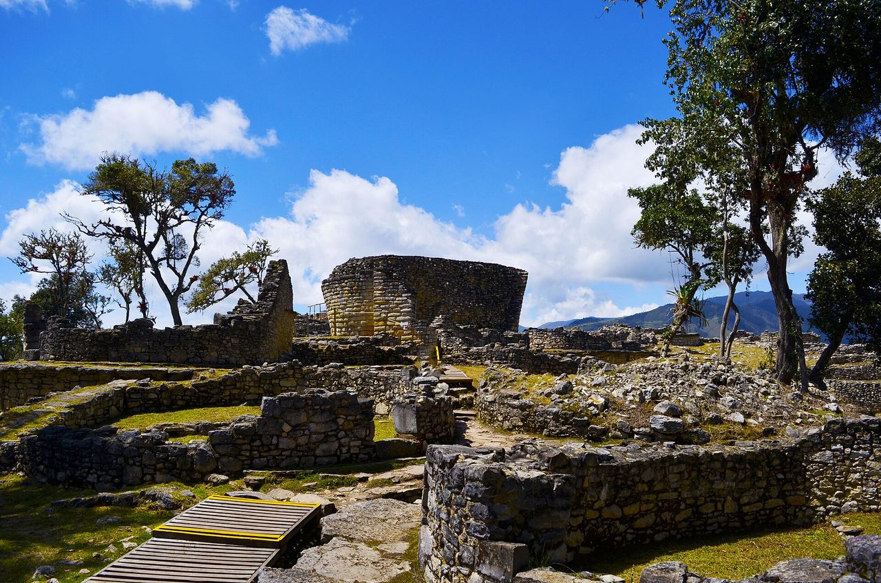
Kuelap annoys me only because of its nickname. Calling it the Machu Picchu of the north sets up a comparison that misses what makes it special: it’s older — construction began around 500–600 AD, roughly 900 years before Machu Picchu — and it’s bigger in enclosed area, a walled citadel running 600 meters along a limestone ridge at 3,000 m, with perimeter walls up to 19 meters high. Inside are the circular stone foundations of more than 400 houses, many decorated with zigzag friezes, draped in bromeliads and orchids. The Incas conquered the Chachapoya late and reluctantly; standing at Kuelap’s narrow keyhole entrance — built so invaders could only pass single file — you understand why it took them so long.
Logistics changed a lot in recent years: a cable car runs from Nuevo Tingo up the valley, and access has reopened progressively after structural repairs to a collapsed wall section. Check current status locally the day before, go early for the morning light, and budget a half day from Chachapoyas town. There’s a real chance you’ll share the site with more llamas than people. I did.
Gocta: a 771-meter waterfall hidden until 2005
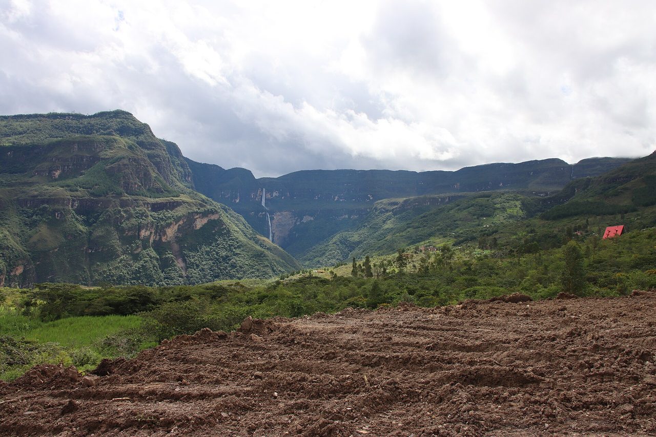
Gocta is a two-tier waterfall dropping 771 meters out of cloud forest — among the tallest in the world depending whose list you trust — and the world only formally “learned” about it in 2005, when a German engineer organized the first measured survey. Locals had always known; they just also knew the mermaid legend that said talking about it brought bad luck. The hike from San Pablo or Cocachimba runs about 5–6 hours round trip through orchids, hummingbirds and the occasional troop of monkeys, and the final stretch gets you close enough to be soaked by spray. It’s muddy, moderately demanding, and one of the best day hikes in Peru. Full trail rundown in my Gocta waterfall guide.
Give Chachapoyas at least one more day for the valley of the dead: the sarcophagi of Karajia, seven two-meter clay figures perched in a cliff niche staring out over the valley, and the painted cliff tombs of Revash. The Leymebamba museum, three hours south, holds 219 mummies recovered from a lake-side cliff necropolis at Laguna de los Condores — rows of them crouched in glass cases, wrapped and eerily intact. It’s a long day trip and worth every minute of the drive.
Huaraz Peru and the Cordillera Blanca: trekking’s best-kept non-secret
Huaraz belongs to the north geographically but to the whole world by reputation — among mountaineers, anyway. Eight hours north of Lima (or a one-hour flight to Anta), the city sits at 3,050 m beneath the Cordillera Blanca: 16 peaks over 6,000 meters, the highest concentration of big tropical mountains anywhere, crowned by Huascaran at 6,768 m, Peru’s tallest. The town itself is functional rather than charming — rebuilt fast after the catastrophic 1970 earthquake — but nobody comes for the architecture. They come because within a day’s reach you have what I’d argue is the best alpine scenery on the continent. My Huaraz guide covers acclimatization, agencies and where to eat; the highlights are these.
Laguna 69 and the day-hike circuit
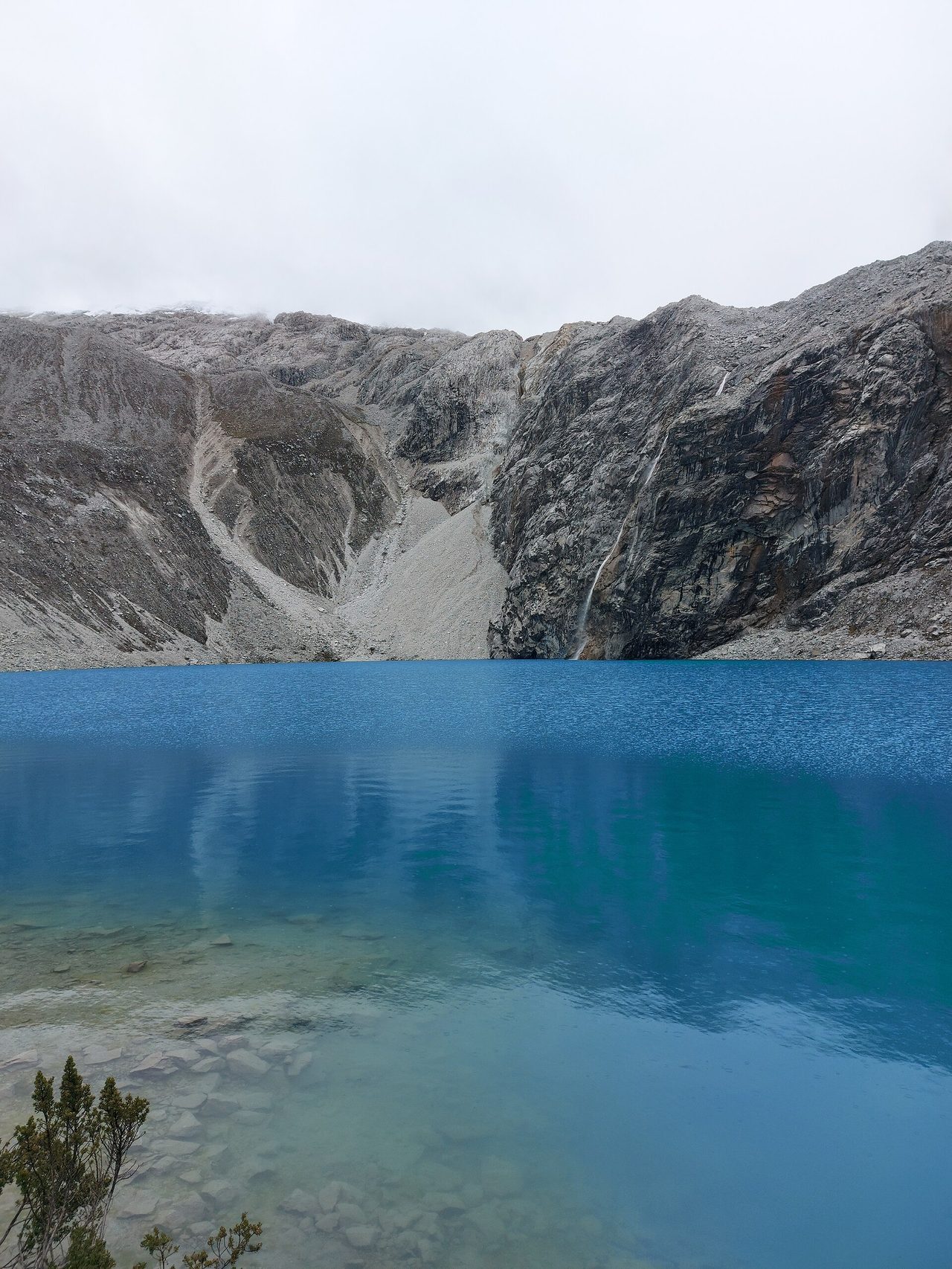
Laguna 69 is the postcard: an unreasonably turquoise lake at 4,600 m under the ice wall of Chacraraju, reached by a steep 13–14 km round-trip hike. It’s hard — the last switchbacks at altitude humble everyone — and it’s popular, but mid-week it never feels like the Inca Trail. Day-trip alternatives that I rate nearly as highly: Laguna Paron (a bigger, bluer lake you can reach with minimal walking), the Pastoruri glacier, and Laguna Churup straight from town for acclimatization. Spend two or three nights at altitude before attempting 69; I’ve watched fit people get wrecked by skipping that step. My Peru travel tips guide covers altitude sickness properly.
Santa Cruz and the multi-day treks
The four-day Santa Cruz trek is the Cordillera Blanca’s classic — over the 4,750 m Punta Union pass, past turquoise lakes and under a parade of 6,000 m faces, doable independently or cheaply with agencies. The 8–12 day Huayhuash circuit, a separate range just south, is the one serious trekkers whisper about: harder, higher, emptier, and routinely ranked among the best treks on earth. If your Peru trip is built around mountains rather than ruins, base in Huaraz and skip Cusco’s crowds entirely — though if you want both, my Inca Trail guide compares the southern options. Chavin de Huantar, a 3,000-year-old cult temple across the range with carved stone heads and torch-lit underground galleries, makes the best rest-day trip.
Cajamarca: where the Inca empire ended
Cajamarca is the north’s overlooked highland city, and it’s a strange omission given what happened here: in 1532, in its main plaza, Francisco Pizarro ambushed and captured the Inca emperor Atahualpa, accepted history’s largest ransom — a room filled once with gold and twice with silver — and executed him anyway. The Cuarto de Rescate, the stone ransom room, still stands a block off the plaza. Today Cajamarca is a milky, green, dairy-farming highland town with thermal baths the Incas themselves used (Banos del Inca, where Atahualpa was camped when the Spanish arrived), the eerie pre-Inca aqueduct of Cumbemayo carved through a forest of rock spires, and Peru’s wildest carnival every February. It pairs naturally with the coast — buses run from Trujillo and Chiclayo in about six hours — or as a stop on the overland route to Chachapoyas.
Building your northern Peru itinerary
Distances up here are the trip-planner’s main enemy, so let me save you the spreadsheet I built the hard way. The north really runs on two axes: the coastal corridor (Trujillo → Chiclayo → beaches) and the inland detours (Huaraz on one branch, Chachapoyas on another). Flights from Lima reach every hub — Trujillo, Chiclayo, Jaen, Talara, Piura, Tumbes, Cajamarca, Anta for Huaraz — and comfortable night buses (Cruz del Sur and Movil Tours are the two I trust) connect the dots. Here are the three builds I actually recommend, depending on your time. For stitching these onto a southern loop, start from my master Peru itinerary page; for the day-by-day version of each, see the dedicated northern Peru itinerary.
10 days — archaeology plus beach: fly Lima to Trujillo (2 nights: Chan Chan, Huacas, Huanchaco), bus to Chiclayo (1 night: Sipan and Tucume), night bus to Chachapoyas (3 nights: Kuelap, Gocta, Karajia), drive to Jaen and fly via Lima to Talara for Mancora (3 nights of doing nothing), fly home from Talara or Piura. This is the single best 10-day loop in Peru that doesn’t contain Machu Picchu, and I don’t say that lightly.
2 weeks — add the mountains: run the 10-day loop, then swap the final beach leg down to three nights and front-load Huaraz: bus from Lima (3–4 nights: acclimatize, Laguna 69, Paron or Churup) before flying north up the coast. Mountains first, beach last — trust me, the order matters. Nobody wants to leave the warm water for a 4,600 m switchback.
3 weeks — the full north: everything above at sane pace, plus the Santa Cruz trek from Huaraz, Cajamarca between the coast and Chachapoyas (the Celendin road is rough but spectacular), and either Tarapoto for a cloud-forest-to-jungle finish or extra days at Punta Sal. Three weeks in the north costs roughly what ten days costs in the Cusco corridor; my Peru trip cost guide has real numbers.
Getting to and around northern Peru
Every northern trip starts in Lima because that’s where the flights are. LATAM and Sky cover the hubs daily; one-way fares booked a few weeks out run $40–80. The trick that unlocks the region is treating flights as bus-replacements: Lima–Jaen for Chachapoyas, Lima–Talara for Mancora, Lima–Trujillo or Chiclayo for the Moche route. Within the region, night buses do the heavy lifting — Chiclayo to Chachapoyas, Trujillo to Cajamarca, the coast road north. Buy the 160-degree or full-cama seats; the $10 difference buys you actual sleep. Mototaxis and colectivos handle towns; shared tours or private drivers handle the sites, since public transport reaches almost none of the archaeology directly. Renting a car is genuinely viable on the coast (the Panamericana is flat and decent) and genuinely not advisable in the Chachapoyas mountains unless you enjoy single-lane cliff roads in fog. The full breakdown lives in my getting to and around Peru guide.
Best time to visit northern Peru
The regions run on different clocks, which is actually good news — there’s no month when all of northern Peru is bad, and several when all of it is decent.
| Region | Best months | Avoid / caveat |
|---|---|---|
| Far north beaches | Year-round; Dec–Mar hottest and liveliest | El Nino years bring coastal rain; Christmas–Easter crowds |
| Trujillo & Chiclayo coast | Year-round; mild desert climate | Garua mist Jun–Sep, fine for ruins |
| Chachapoyas cloud forest | May–Sep (drier trails) | Oct–Apr is muddy; Gocta fullest in rain, paths slick |
| Huaraz / Cordillera Blanca | May–Sep (clear peaks, dry trails) | Dec–Mar wet season buries views in cloud |
| Cajamarca | May–Sep dry; February for carnival | Carnival week books out months ahead |
If I had to pick one window for a do-everything northern trip: June through September. Dry trails in the mountains and cloud forest, fine beach weather (a touch cooler, still 24°C water), plus whale season on the far north coast from July. Detail by month in my best time to visit Peru guide.
Is northern Peru safe?
The honest answer: the tourist circuits are safe, the cities deserve normal Peruvian-city caution. In Chachapoyas, Huaraz, Huanchaco, Mancora and the beach towns I’ve never felt a moment’s unease beyond watching my phone in markets. Trujillo and Chiclayo have genuine street-crime problems in specific districts — use registered taxis at night, keep valuables out of sight, stay in the recommended neighborhoods (or just base in Huanchaco instead of central Trujillo, which is what I do). The Tumbes border zone with Ecuador calls for standard border-town awareness. None of this differs much from Lima or Cusco advice; it’s petty theft you’re managing, not anything dramatic. My Peru travel tips, safety and health guide goes deeper on taxis, scams, water and altitude.
What to eat in the north (you’re in Peru’s best food region)
Strong claim, deliberately made: the north is Peru’s best eating, and Peruvian food is already the continent’s best. The warm seas off Piura and Tumbes produce the country’s sweetest ceviche — conchas negras (black scallops) in Tumbes, mero and ojo de uva up and down the coast. Chiclayo gave Peru arroz con pato (duck rice cooked in cilantro and dark beer) and king kong, an alfajor the size of a brick. Trujillo counters with shambar soup on Mondays and cabrito al horno. Chachapoyas does highland-jungle hybrids: juanes, cecina, tacacho, coffee that wins international awards. Even Cajamarca’s contribution — proper cheese and manjar blanco — matters when you’ve been eating trail snacks in Huaraz for a week. Order the menu del dia anywhere locals queue and you’ll eat for S/12–18.
Where to stay across the north
Accommodation in northern Peru runs cheaper than the Cusco corridor at every tier, with one twist: the far north beaches have a genuine boutique-luxury scene (Vichayito and Las Pocitas especially, $150–400 a night) while the archaeology towns top out at comfortable three-star. My picks, short version: Huanchaco over central Trujillo for atmosphere and safety; within two blocks of the Plaza de Armas in Chachapoyas, where converted colonial houses with courtyards go for $30–60; the Olivos/San Martin end of Huaraz for mountain-view rooftops; Las Pocitas if you want Mancora’s restaurants without its 3am reggaeton; a resort in Punta Sal if the assignment is swim-eat-sleep. Dorm beds run S/30–45, solid doubles $25–50, and the beach lodges are the only place you’ll spend real money. Region-by-region detail is in my where to stay in Peru guide.
What a northern Peru trip costs
Budget travelers do the north comfortably on $35–45 a day — less than the south, because entrance fees are a fraction of Machu Picchu’s and nobody is charging Sacred Valley prices for lunch. Mid-range couples should plan around $70–110 per person per day including internal flights. The big-ticket items are few: flights from Lima ($40–80 each), the Kuelap cable car and site (under S/40 combined), Gocta entrance and optional guide (S/20–50), Chan Chan’s two-day ticket (S/11 — eleven soles, I checked it twice), full-day tours from any hub (S/50–120), and Santa Cruz trek packages from Huaraz ($120–200 for four days, gear included). Beach lodges are where budgets go to die, voluntarily. Full worked budgets — backpacker, mid-range and flush — are in the Peru trip cost guide.
Northern Peru vs southern Peru: which should you choose?
If it’s your first time in the country and you have under two weeks, do the south — I’d never talk someone out of Machu Picchu, and the classic things to do in Peru are classics for a reason. But here’s my actual position, having done both several times: the north is the better second trip, and for two specific kinds of traveler it’s the better first one. Surfers and beach people, obviously — the south has no answer to Mancora, and the southern coast is a desert-and-wildlife stop, not a swim. And archaeology people, less obviously — the pre-Inca north out-delivers the Inca south on tombs, murals and museums, even if no single site matches Machu Picchu’s setting. Crowds? No contest. I shared Kuelap with eleven people on a Saturday. Machu Picchu admits that many every ninety seconds.
Northern Peru FAQ
Is northern Peru worth visiting?
Emphatically yes — if you match the region to your interests. It holds Peru’s only warm-water beaches, its richest pre-Inca archaeology (Chan Chan, Sipan, Kuelap), its best trekking outside Cusco (the Cordillera Blanca), and a fraction of the south’s tourism. It is not where you go for Inca sites or polished infrastructure.
How many days do you need in northern Peru?
Ten days covers one strong loop — the Moche coast plus Chachapoyas plus a beach finish, or Huaraz plus the coast. Two weeks lets you add the mountains properly. Three weeks does the whole region without night-bus fatigue. A single region — just Mancora, or just Huaraz — rewards even 4–5 days.
Is northern Peru safe for tourists?
The tourist routes are safe with standard precautions. Beach towns, Chachapoyas, Huaraz and Huanchaco feel relaxed; central Trujillo and Chiclayo warrant registered taxis at night and basic street smarts. Petty theft is the realistic risk, not violent crime against travelers.
What is the Machu Picchu of the north?
Kuelap, the walled mountaintop citadel of the Chachapoya culture near Chachapoyas. It predates Machu Picchu by roughly 900 years, encloses a larger area, and receives a tiny fraction of the visitors. Reached via cable car from Nuevo Tingo plus a short uphill walk.
Which is the best beach town in northern Peru?
Mancora for energy, lessons and nightlife; Punta Sal for calm warm swimming; Vichayito for barefoot luxury; Los Organos for low-key surf and whale season (July–October); Huanchaco if you want waves next to world-class ruins. There’s a genuinely correct answer for every traveler type, which is the north coast’s superpower.
How do I get from Lima to Mancora?
Fly Lima to Talara (around 1 hr 45 min), then a 50–70 minute taxi or shuttle north to Mancora. Piura (2.5 hr drive) and Tumbes (1.5 hr, closer to Punta Sal) are alternates. The direct bus is 18–20 hours — doable on a full-cama seat, but the flight usually costs barely more.
Can you visit northern Peru without speaking Spanish?
Yes, but pack patience and a translation app. Outside Mancora’s hostels and the bigger hotels, English thins out fast — site guides at Kuelap or Sipan often work in Spanish only. Booking English-speaking guides ahead through your hotel solves the museum days, and basic courtesy Spanish opens every door in between.
Should I combine northern Peru with Machu Picchu?
With two-plus weeks, absolutely: fly the southern circuit first (Cusco, Sacred Valley, Machu Picchu), return via Lima, then run north for beaches or Chachapoyas. Internal flights make the pivot painless. With under twelve days, pick one half of the country and do it justice.
The bottom line
Northern Peru is what travel looked like before timed entry tickets: huge sites, no queues, locals genuinely pleased you came. Fly the long legs, take the night buses where they earn their keep, eat everything Chiclayo puts in front of you, and give Chachapoyas more days than feels reasonable. Then come back and tell me the north was a mistake — nobody ever has. When you’re ready to build the trip, start with the northern Peru itinerary, check when to go, and budget it properly with the trip cost guide. The north has waited five centuries for its turn; it’ll wait for your second trip to Peru, too. It just shouldn’t have to.