Peru Weather & Climate by Region
Cusco freezes at night while Machu Picchu, 1,000 m lower, stays at 9C. Peru has no single climate — here is what altitude, the Humboldt Current and El Niño actually do, region by region, with real station numbers.
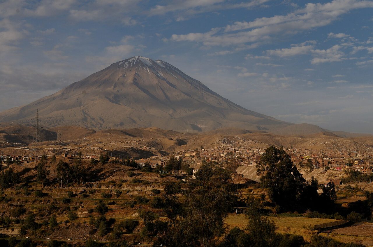
Two Peruvian weather stations sit almost exactly 1,000 metres apart in altitude and about three hours apart by train. In July, Cusco averages a nightly low of 1.2C. Machu Picchu averages 9.4C. Same latitude, same month, same country, and an eight-degree gap in the temperature that actually decides how well you sleep. That gap is the whole story of Peru weather, and it is the thing most guides flatten out by lumping the country into one dry season and one wet season.
Asking what the weather is like in Peru is close to asking what the weather is like in Europe. The honest answer is a question back: where, and at what altitude. Peru packs a fog-bound coastal desert, a high-altitude mountain range where the sun can burn you at 4C, and a rainforest that gets more rain in its driest month than Cusco gets in three, into a country you can cross in a two-hour flight.
What follows is built around the two forces that actually control the climate here — altitude and the Humboldt Current — rather than around a month-by-month calendar. If you want the calendar version, the overview of when to go and the month-by-month breakdown that grades all twelve handle that. This page explains why the numbers look the way they do, and gives you the numbers.
The one thing to understand first: Peru is three countries stacked sideways
Peruvians divide their own country into three strips that run north to south, and every conversation about climate here starts with them.
La costa is a ribbon of desert, 2,500 km long and rarely more than 100 km wide, squeezed between the Pacific and the western wall of the Andes. It contains Lima, roughly a third of the population, and almost no rain.
La sierra is the Andes: Cusco, Arequipa, Puno, Huaraz, the Sacred Valley. Here the calendar splits cleanly into a dry season (roughly May to September) and a wet season (roughly November to March), and altitude, not the month, sets the temperature.
La selva is the Amazon basin east of the mountains, about 60 per cent of Peru’s land area and under 10 per cent of its people. Hot, humid, and wet all year, with a wetter stretch and a less-wet stretch rather than a real dry season.
These three do not share a season. In August the sierra is bone dry and sunny, Lima is under a grey lid, the north coast is warm and clear, and the Amazon is at its most walkable. In February the sierra is soaked, Lima is hot and bright, and the Amazon is at high water. There is no month when all of Peru is at its best, which is why any itinerary that tries to do coast, mountains and jungle has to accept a compromise somewhere. Working out where to take that hit is most of the job when you put a Peru route together.
Altitude beats latitude: the rule that explains the Andes
Peru sits between roughly 0 and 18 degrees south. On latitude alone it should be uniformly tropical. It is not, because air cools as it rises. The rough working figure is about 6C lost per 1,000 metres of elevation gain, and in the Peruvian Andes it holds up well enough to plan around.
The cleanest demonstration is the Cusco–Machu Picchu pair, because they are almost exactly 1,000 metres apart:
| Cusco (3,399 m) | Machu Picchu (approx. 2,400 m) | Difference | |
|---|---|---|---|
| July average high | 20.6C / 69F | 22.1C / 72F | +1.5C |
| July average low | 1.2C / 34F | 9.4C / 49F | +8.2C |
| January average low | 8.0C / 46F | 11.8C / 53F | +3.8C |
| Annual rainfall | 728 mm | 2,116 mm | 2.9x wetter |
Two things fall out of that table, and they are the single most useful correction in this article. First, Machu Picchu is meaningfully warmer than Cusco, especially at night — people pack for the ruins based on what they felt in Cusco and end up carrying a down jacket around a humid cloud forest. Second, Machu Picchu is far wetter. It sits on the eastern flank of the Andes where moist Amazon air runs into the mountains and dumps its load, and it gets nearly three times Cusco’s rain. Its driest month, June, still delivers about 51 mm — more than Cusco gets in June, July and August combined. If you have been told the dry season means dry at Machu Picchu, adjust. It means drier. The clothing you actually want at the citadel is closer to what you would take to a temperate rainforest than to a mountain.
The lapse rate also explains why the sierra’s daytime highs barely move across the year. Cusco averages 20.6C in July and 20.5C in January. The sun angle changes very little this close to the equator, so the days stay the same. What changes is the cloud cover at night: in the wet season a blanket of cloud traps the day’s heat, and in the dry season clear skies let it radiate straight out to space. That is why Cusco’s dry season, counterintuitively, has the cold nights. The dry season in the Andes is the sunny one and the freezing one at the same time.
One caveat on the 6C-per-1,000-m rule: it works within the mountains, not from the coast upward. Lima at 13 m has a July average high of 19.6C while Cusco at 3,399 m has 20.6C. The mountain city is warmer by day than the sea-level one. That is not a broken rule, it is the Humboldt Current, and it deserves its own section.
Why Peru’s coast is a desert, and why Lima is grey
The Humboldt Current drags cold water north up the coast of Chile and Peru from the Southern Ocean, reinforced by upwelling that pulls more cold water from the deep. Coastal sea temperatures off Lima sit around 17–19C. For 12 degrees south of the equator, that is absurdly cold — comparable to the sea off Cornwall in late summer.
Cold water chills the air immediately above it. That cold air is dense and it sits, while warmer air from the South Pacific anticyclone caps it from above. The result is a temperature inversion: a stable lid over the coast that stops air rising, and air that cannot rise cannot form rain clouds. Moisture that evaporates off the sea gets trapped in a shallow layer and turns into fog and drizzle instead of weather.
So Lima is simultaneously one of the most humid cities you will visit and one of the driest. Relative humidity runs above 80 per cent for much of the year. Annual rainfall at the airport station is about 6 mm. Inland districts, which catch a bit more of the drizzle against the foothills, manage something in the 10–60 mm range. Coastal districts get 10–30 mm. Any source telling you Lima gets around 200 mm a year is repeating a modelled figure that badly overestimates coastal Peru; the measured numbers are an order of magnitude smaller. Lima is the third-largest desert city on Earth after Karachi and Cairo, and it is frequently described as the second-driest capital in the world.
The grey is the other half. From roughly late May to mid-November the inversion produces a persistent low cloud deck and the garúa — a fine drizzle that wets the pavement in the morning and has usually dried by lunch. It is not rain in any meaningful sense. It will not fill a rain gauge and it will not soak you. It will, however, remove the sun for weeks. Ten to fifteen consecutive days of flat overcast is normal in August.
The sunshine numbers make the point better than adjectives: Lima records about 1,284 hours of sunshine a year, against roughly 1,653 for London. In August it manages 27.9 hours for the entire month — under an hour a day. In April it gets 183. A capital at 12 degrees south, in a desert, with less sun than London. That is the Humboldt Current doing its work.
| Month | Avg high | Avg low | What it feels like |
|---|---|---|---|
| January | 26.8C / 80F | 20.4C / 69F | Hot, bright, humid. Beach season. |
| February | 28.0C / 82F | 21.0C / 70F | Peak heat. Best month for sun in Lima. |
| March | 27.6C / 82F | 20.5C / 69F | Still summer. Sea at its warmest. |
| April | 25.4C / 78F | 18.7C / 66F | Pleasant, sunny, quieter. Underrated. |
| May | 22.8C / 73F | 17.3C / 63F | Transition. The lid starts to close. |
| June | 20.5C / 69F | 16.6C / 62F | Grey sets in. Damp, cool, still. |
| July | 19.6C / 67F | 15.9C / 61F | Overcast. Garúa most mornings. |
| August | 19.2C / 67F | 15.4C / 60F | Greyest month. 28 hours of sun. |
| September | 19.6C / 67F | 15.3C / 60F | Coldest nights of the year. Still grey. |
| October | 20.8C / 69F | 16.0C / 61F | Lid begins to lift, slowly. |
| November | 22.4C / 72F | 17.1C / 63F | Sun returns in patches. |
| December | 24.4C / 76F | 18.6C / 65F | Summer proper. Warm and clear. |
Note the range. Lima’s hottest month averages 28C and its coolest 19.2C. That is a nine-degree annual swing in a city people describe as having no seasons. It has seasons, they are just gentle, and the thing that changes most is not the temperature but the light. If you are planning time in the capital and photographs matter to you, January to April is a different city from June to September.
Two practical notes. Lima buildings almost never have heating, because it never gets cold enough to justify it, so a 15C night indoors with 85 per cent humidity feels colder than the number suggests. And Lima’s beaches in winter are not a swimming proposition — the water is 16–17C and the sky is grey. Peruvians who want winter sun fly north or drive up into the Andean valleys, where 500 m of elevation gets you above the cloud deck into brilliant sunshine.
El Niño and La Niña: what is actually happening right now
Almost every competing guide skips this, and it is the one variable that can genuinely wreck a trip to northern Peru. The El Niño–Southern Oscillation is a periodic warming and cooling of the central and eastern equatorial Pacific, and Peru sits directly in its firing line — the phenomenon is named after the Peruvian coast, where fishermen noticed the warm water arriving around Christmas.
In an El Niño phase, warm water displaces the cold Humboldt water along the coast. The inversion that keeps the desert dry breaks down. The north coast, normally the driest inhabited part of the country, gets torrential rain, rivers that have not run in years flood, roads and bridges wash out, and the anchoveta fishery collapses because the cold nutrient-rich upwelling that feeds it has shut off. Lima gets warmer and less foggy. In the southern Andes, El Niño tends to suppress wet-season rainfall, which sounds pleasant for trekkers but means drought risk for altiplano farmers.
La Niña is roughly the mirror: cooler-than-normal coastal water, an even drier north coast, and a tendency toward heavier rain in the southern highlands.
Peru also gets a regional variant, El Niño costero — a coastal warming that can occur even when the basin-wide index is neutral. The 2017 coastal event caused severe flooding and landslides across Piura, Lambayeque and Tumbes while the global ENSO signal was unremarkable. So a neutral global forecast is not the same as a safe north coast.
The 2026–27 outlook
As of the mid-2026 forecast round, this matters more than usual. El Niño conditions are established and strengthening: the Niño 3.4 index averaged +0.98C across April to June 2026, rose to +1.55C in June, and the weekly value passed +2.1C by mid-July. The Southern Oscillation Index has gone strongly negative, meaning the atmosphere is coupling to the warm ocean rather than just sitting over it. Forecast models are unusually unanimous: essentially a 100 per cent probability of El Niño conditions persisting from mid-2026 through early 2027, with the event projected to peak around October to December 2026, and the large majority of models putting it in the very strong category (Niño 3.4 at or above +2.0C).
What that means in practice, if the forecast holds:
- The 2026–27 wet season on the north coast (roughly December to March) is a genuine risk period. Máncora, Piura, Tumbes, Chiclayo and Trujillo are the exposure. Strong El Niño years have historically brought flooding, landslides and closed sections of the Panamericana Norte.
- Lima should be warmer and less grey than usual through late 2026, which is the one upside.
- Southern Andean rainfall may run below normal, which can mean a drier-than-usual wet season around Cusco and Puno — better for trekking, worse for water supply.
- Seafood and fishing-dependent prices can move, and marine wildlife trips down the coast can disappoint when the cold-water food chain shifts.
Treat all of that as a forecast, not a fact. ENSO predictions made in mid-year are more reliable than ones made in spring, but they still move. Before committing to north-coast dates in the 2026–27 window, check Peru’s national meteorological service SENAMHI and NOAA’s Climate Prediction Center, and buy travel insurance that covers weather disruption. If you have flexibility, a strong El Niño year is an argument for putting your time in the north of the country in the middle of the year rather than in January.
Peru weather region by region, with real numbers
Here is the master table. Every figure is a station normal rather than an estimate, so you can plan against it.
| Place | Elevation | Jan high / low | Jul high / low | Annual rain | Wettest | Driest |
|---|---|---|---|---|---|---|
| Lima | 13 m | 26.8 / 20.4C | 19.6 / 15.9C | ~6 mm | Aug (drizzle) | Apr–May |
| Trujillo | 34 m | 27.1 / 19.4C | 21.4 / 15.9C | 22 mm | Mar | Jun–Aug |
| Piura (north) | 55 m | 33.8 / 22.1C | 28.1 / 17.6C | 116 mm | Mar | Aug–Sep |
| Arequipa | ~2,330 m | 21.8 / 8.5C | 21.7 / 5.2C | ~95 mm | Feb | Jun–Jul |
| Machu Picchu | ~2,400 m | 20.6 / 11.8C | 22.1 / 9.4C | 2,116 mm | Jan | Jun |
| Huaraz | ~3,050 m | 22.2 / 8.2C | 23.4 / 4.3C | 803 mm | Mar | Jul–Aug |
| Cusco | 3,399 m | 20.5 / 8.0C | 20.6 / 1.2C | 728 mm | Jan | Jun |
| Puno | ~3,825 m | 16.0 / 5.9C | 14.9 / −0.8C | 689 mm | Jan | Jun |
| Iquitos | 104 m | 32.0 / 22.1C | 31.3 / 21.5C | ~2,850 mm | Mar | Jul |
| Puerto Maldonado | 183 m | 30.9 / 21.4C | 29.6 / 16.8C | 2,167 mm | Jan | Jul |
Read down the elevation column and then the July low column and the lapse rate jumps out at you: 15.9C at sea level in Lima, 9.4C at 2,400 m, 4.3C at 3,050 m, 1.2C at 3,400 m, below freezing at 3,825 m. That is the only chart you really need.
Lima and the central coast
Covered above. Summary: warm and bright December to April, grey and cool June to October, essentially no rain ever. The central and southern coast — Paracas, Ica, Nazca — sits south of Lima and gets progressively sunnier and drier as you go inland from the water, which is why the desert stretch south of the capital is reliably clear even when Lima is under cloud. Huacachina, 300 m up and 5 km from the sea, escapes the cloud deck entirely.
The north coast: Peru’s reliable sun
North of about Trujillo, the Humboldt Current loses its grip and the coast turns properly tropical. Piura averages a January high of 33.8C. Máncora and the Tumbes beaches have sea temperatures of 24–26C from December to May and 21–23C the rest of the year — genuinely swimmable, unlike anywhere south of them.
The critical point for planning: the north coast is sunny when Lima is grey. Between June and September, when the capital sees under an hour of sun a day, Máncora is running daytime temperatures in the mid-to-high 20s with clear skies. Peruvians know this and the northern beaches are busy through the southern winter. The trade-off is that this is also the region El Niño punishes, so the years when the south is having a mild wet season can be the years the north floods.
Arequipa: testing the “city of eternal spring” claim
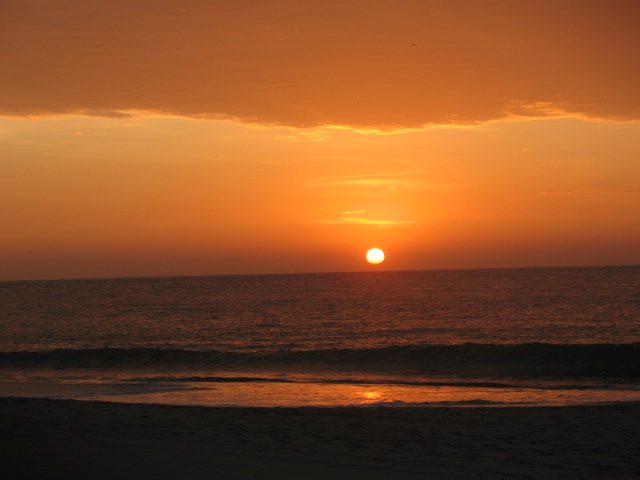
Arequipa markets itself hard on climate, and mostly it earns it. At roughly 2,330 m it averages a high of about 21.7C in July and 21.8C in January — a variation of one-tenth of a degree across the year. Annual rainfall is under 100 mm and June and July are effectively zero. It gets around 300 hours of sunshine a month for most of the year. If you want a Peruvian city where you can pack one outfit and be right every day, this is it.
The honest correction is the nights. Arequipa’s July low averages 5.2C, and the daily swing is therefore about 16C. Days genuinely are spring-like. Nights in the dry season are cold, colonial buildings are unheated, and the sillar volcanic stone the city is built from holds that cold well. “Eternal spring” describes the afternoons. Pack for the mornings. A few days in Arequipa and the Colca Canyon is also a sensible altitude step before Cusco, and Colca itself sits considerably higher and colder than the city.
Cusco and the Sacred Valley
Cusco at 3,399 m is the reference point for most Peru trips. Days are steady all year at 20–22C. Nights are where the season lives: about 8C in January, about 1.2C in July, with frost common on clear dry-season mornings and a record low of −7C. Annual rainfall is 728 mm and it is heavily concentrated — January alone brings 153 mm across roughly 20 rain days, while June manages 3.3 mm across a single one.
The Sacred Valley sits 400–600 m lower, around Urubamba and Ollantaytambo, and that shows up as noticeably warmer nights and a gentler arrival. Plenty of people now sleep in the valley rather than the city for exactly that reason, and it helps with acclimatisation too — worth reading up on how Cusco’s altitude affects you before you build the schedule. The seasonal detail that catches people out is that wet-season rain here is usually an afternoon event rather than an all-day one. Mornings in January are often clear. If you are choosing specific dates for Cusco, the shoulder months of April, May and October give you green landscapes with mostly settled weather.
Puno and Lake Titicaca: the cold end
At about 3,825 m, Puno is the coldest place most travellers go in Peru. The July average low is −0.8C, and both June and July have mean daily minimums below freezing. Daytime highs only reach 14–15C. The annual mean temperature is under 10C.
The lake moderates things slightly for anything on the water, but the Uros and Amantani homestays are the coldest nights on a standard Peru circuit and they are unheated. If you are doing an overnight on Titicaca between May and August, this is the one place where a serious insulated layer and a hat for sleeping is not overkill. Thin air at 3,800 m also holds very little heat once the sun drops, so the temperature falls fast in the hour after sunset rather than gradually through the night.
Machu Picchu and Aguas Calientes
The single most useful thing in this article, repeated because people keep getting it wrong: the citadel at 2,430 m is warmer, wetter and more humid than Cusco. July nights average 9.4C against Cusco’s 1.2C. Annual rainfall is 2,116 mm against 728 mm. Aguas Calientes, down in the gorge at around 2,040 m, is warmer and stickier still.
Practically: you want a light waterproof and layers you can shed on the walk up, not a heavy coat. Mist and low cloud in the mornings are routine in every month, and often burn off by mid-morning — an early entry that looks ruined at 6am is frequently clear by nine, which is a reason not to leave. Rain here is heavy and short rather than persistent drizzle. Anyone deciding which month to book the citadel should weigh crowds at least as heavily as rain, and if you are still working out the logistics, the train options into Aguas Calientes are the part most affected by weather — the line follows the Urubamba and has been closed by landslides in severe wet seasons.
One hard scheduling fact: the classic Inca Trail closes every February for maintenance, which is also the heart of the wet season. Alternative treks run, but the trail itself does not.
Huaraz and the Cordillera Blanca
Huaraz at roughly 3,050 m has a quirk worth knowing: July to September are both the driest months and the warmest days of the year, at 23–24C. July and August each average 2.5 mm of rain. Nights drop to about 4.3C in July, and much colder at trekking altitude — the passes on the Santa Cruz and Huayhuash circuits sit well above 4,500 m and drop below freezing routinely.
That combination is why the Cordillera Blanca has a much sharper trekking window than the Cusco region: outside roughly May to September the high routes are genuinely unpleasant and often unsafe. If multi-day trekking is the point of your trip, the northern Andes narrow your dates far more than Machu Picchu does.
The Amazon: Iquitos versus Puerto Maldonado
These get treated as one destination and they are not. Iquitos, at 104 m and only three degrees south of the equator, has effectively no seasons at all: the difference between its warmest and coolest month is under 1.5C, and its driest month still delivers 170 mm across ten rain days. Annual rainfall is somewhere around 2,850 mm across roughly 148 rain days. You will get rained on. The variable that actually matters there is river level, not rain — high water (roughly December to May) lets boats reach flooded forest that is inaccessible the rest of the year, while low water (June to August) exposes beaches and concentrates wildlife along shrinking channels.
Puerto Maldonado, 1,700 km south at 183 m, is meaningfully more seasonal: 2,167 mm a year, with January at 343 mm and July at just 57 mm. It has a real dry season, which is why most Tambopata lodges push the June to September window.
It also has the friaje, and this one surprises people badly. Several times a year, mostly between May and August, a mass of cold polar air pushes north from Patagonia across the flat basin and the temperature in the southern Peruvian Amazon drops from the low 30s to as low as 8C for two or three days. The record low at Puerto Maldonado is 4.5C, in July. Nobody packs a fleece for the jungle. You should. It is also the reason wildlife viewing goes quiet during a friaje — insects and reptiles shut down, and the birds follow. Worth knowing if wildlife is the reason you are going, and worth factoring into any Amazon lodge booking.
What this actually means for your bag
The mistake almost everyone makes is packing for a temperature rather than for a range. In the Andes the daily swing is roughly double the seasonal one — Cusco moves 19C between a July afternoon and a July dawn, but only about 7C between a July night and a January night. You are not packing for winter. You are packing for four seasons within one day.
| Region | The real problem | What you actually need |
|---|---|---|
| Lima & central coast | Damp cool, no heating indoors, no rain | Light layers, a jumper for evenings. A rain jacket is close to dead weight. Skip the umbrella. |
| North coast | Strong sun, warm sea | Shorts, swimwear, high-factor sunscreen, a hat. A light layer for evenings Jun–Sep. |
| Arequipa | 16C daily swing, cold unheated buildings | T-shirt weather by day, a proper warm layer after dark. Sunglasses. |
| Cusco, Sacred Valley, Puno | Freezing dawns, hot afternoons, extreme UV | Base layer, fleece or wool mid-layer, and a real down or synthetic insulated jacket for nights. Not a heavy overcoat — it is bulk you cannot shed. Gloves and a hat for Puno. |
| Machu Picchu & Aguas Calientes | Warm, humid, wet, steep | Light waterproof shell, quick-dry layers, grippy shoes. Leave the down jacket in Cusco. |
| Huaraz & high treks | Sub-zero camps above 4,000 m | Proper four-season sleeping bag, insulated jacket, gloves, sun protection. This is real mountain kit. |
| Amazon | Heat, humidity, rain, and friaje cold snaps | Long light sleeves, quick-dry trousers, poncho, repellent — plus one fleece if travelling May–Aug. |
Two things to buy or bring regardless. Sunscreen at factor 50, and a wide-brimmed hat. UV intensity rises roughly 10–12 per cent per 1,000 m of altitude, and the Peruvian Andes sit at tropical latitude on top of that. Readings in the extreme band are routine around Cusco, and the region is sometimes cited as having among the highest average UV of any inhabited place on the planet. Because the air is cold, you get no warning — there is no heat on your skin to tell you to move into the shade. Burning through thin cloud on an overcast Cusco day is completely normal, and a day at Vinicunca above 5,000 m will do it in under an hour. Thin high-altitude air also scatters far less UV away, so reflected light off snow doubles your exposure.
And a reusable water bottle. Dry cold air at altitude dehydrates you faster than heat does, because you lose water through your breath without noticing it, and dehydration makes altitude symptoms markedly worse. There is more on that in the general practical advice for travelling in Peru.
Three things nobody warns you about
Wet season does not mean washout. In the sierra, wet-season rain typically arrives in the afternoon and lasts an hour or two. Mornings in January are frequently clear and the landscape is green rather than the dusty brown of August. You lose reliability, you gain scenery and lower prices. What you should genuinely avoid is scheduling a single-shot, non-refundable high-altitude activity in February and having no spare day.
Andean roads are the real seasonal risk, not the rain itself. Landslides close mountain roads and rail lines during heavy wet-season weeks. It is rarely dangerous if you are sensible, but it eats days. Build slack into any wet-season plan involving overland travel, and understand how the transport network fits together before you rely on a tight connection.
The dry season is the cold season, and the busy one. June to August gives you the best weather in the Andes and also the highest prices, the fullest trains and the most competition for permits. The last week of June is worse still because Inti Raymi and the winter festival calendar land then. April, May, September and October are the sweet spot: mostly settled weather, thinner crowds, better rates. If your dates are fixed by school holidays you take what you get, but if they are not, the shoulder months are the better trade.
Frequently asked questions
What is the best time of year to visit Peru?
For the Andes and Machu Picchu, May to September is the driest and most reliable, with May and September giving you most of the weather and fewer of the crowds. For Lima and the central coast, December to April. For the north coast beaches, roughly any month, though December to April is hottest. For the southern Amazon, June to September. If you have to pick one month that works acceptably everywhere, take May.
What is the rainy season in Peru?
In the Andes and Amazon it runs roughly November to March, peaking in January and February. The coast has no rainy season in any normal sense — Lima gets around 6 mm of rain a year, and what falls between June and September is fog drizzle rather than rain.
What is the rainiest month in Peru?
January or February for most of the country. January brings 153 mm to Cusco, 159 mm to Puno and 341 mm to Machu Picchu. In the Amazon the peak shifts slightly later — March is the wettest month in Iquitos at 299 mm.
What is the coldest month in Peru?
July, in the highlands. Cusco averages a nightly low of 1.2C and Puno −0.8C. On the coast the coldest nights are actually in August and September, which lag the solstice because the ocean takes time to cool.
Is Machu Picchu warmer than Cusco?
Yes, and by more than most people expect. The citadel sits 1,000 m lower and averages July nights of 9.4C against Cusco’s 1.2C. It is also almost three times wetter, at 2,116 mm a year against 728 mm. Pack a waterproof for Machu Picchu and the warm layers for Cusco.
Does it snow in Peru?
Not in the cities you will visit. Cusco, Puno and Huaraz all sit below the permanent snow line and see frost rather than snowfall, though a freak flurry happens occasionally. Snow is normal above roughly 4,800–5,000 m, so high trekking passes and the peaks of the Cordillera Blanca get it. It never snows on the coast or in the Amazon.
How cold does it get at night in the Andes?
In Cusco, around freezing on a clear July night, with a record of −7C. In Puno, below freezing as a monthly average in June and July. On high treks, camps above 4,000 m routinely drop to −5C or lower. The wet season is milder at night because cloud cover traps the day’s heat.
Why is Lima always grey?
A temperature inversion caused by the cold Humboldt Current. Cold sea chills the air above it, warm air from the South Pacific anticyclone caps it, and the trapped moist layer becomes a low cloud deck that sits over the city from about late May to mid-November. It produces the garúa drizzle but almost no measurable rain. Lima gets about 1,284 hours of sunshine a year, fewer than London.
Which part of Peru has the best climate?
Arequipa, on the numbers. Roughly 21.7C every single afternoon of the year, under 100 mm of annual rain and around 300 hours of sun a month. The catch is 5C nights in July. If you want warmth rather than mildness, the north coast around Máncora is the answer.
How does El Niño affect Peru?
It warms the coastal ocean, breaks down the inversion that keeps the coast dry, and brings heavy rain and flooding to the normally arid north coast. It collapses the anchoveta fishery, warms and clears Lima, and tends to suppress rainfall in the southern Andes. A strong El Niño is developing through late 2026 and forecast to peak around October to December, so the 2026–27 December-to-March window on the north coast carries above-average disruption risk. Check SENAMHI forecasts before booking.
What should I pack for Peru’s weather?
Layers, and one genuinely warm insulated jacket rather than a bulky coat. Add a light waterproof shell, factor-50 sunscreen, a brimmed hat and sunglasses for the altitude, and long light sleeves plus repellent for the jungle. If you are travelling to the southern Amazon between May and August, add a fleece for the friaje. Almost nobody needs the heavy winter coat they bring.
The short version
Peru does not have a climate, it has an altitude profile. Work out how high each stop on your route is and you can predict the temperature within a couple of degrees without looking anything up. Add the Humboldt Current to explain why the coast is a fog-bound desert, add El Niño to explain why the north coast occasionally floods, and you have the whole system. The dry season in the mountains is the sunny one and the cold one at the same time, the wet season is greener and cheaper and rains mostly in the afternoon, and Machu Picchu is warmer and far wetter than the city you will fly into. Everything else is detail. If you are still deciding where the trip goes at all, the rundown of the places worth your days is the place to start.