Rainbow Mountain (Vinicunca): Day Trip Guide
The summit is 5,036 metres, the walk starts higher than any point on the Inca Trail, and the colours are regularly hidden by snow or flattened by cloud. Here is what the day really involves, what it costs, and when Palccoyo is the smarter call.
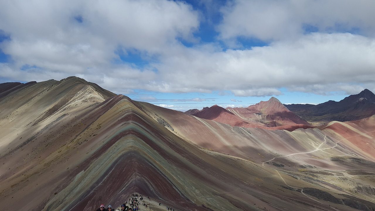
At about half past nine in the morning, roughly five kilometres above sea level in the Cusco region, there is a queue. It is single file, it moves at the pace of the slowest person on it, and it ends at a narrow ridge where everybody takes the same photograph from the same spot. That ridge is Vinicunca. Rainbow Mountain Peru has become the second most visited attraction in the region after the citadel at Machu Picchu, on a site that essentially nobody had heard of fifteen years ago.
I want to be straight with you about this one, because the internet is not. Almost every page ranking for this mountain was written by a company selling the tour, and there are two facts they consistently bury. The first is how high it is. The second is that the colours are not always there.
Neither of those makes the trip a bad idea. They just change who should go, when, and how much preparation is honest rather than optional. This is the hardest thing most visitors to Peru will physically attempt, and whether it is worth the 4am alarm depends almost entirely on how well you prepared and how lucky you get with the weather.
Two things nobody tells you about Rainbow Mountain Peru
Here they are, up front, before the logistics.
One: the summit is around 5,036 metres. That is higher than Mont Blanc, the highest mountain in western Europe. It is roughly 330 metres below Everest Base Camp on the Nepal side, which sits at 5,364 metres. Trekkers spend eight to twelve days walking to Everest Base Camp specifically so their bodies can adjust. At Vinicunca, people fly into Cusco on Tuesday and stand at almost the same altitude on Thursday morning, having slept two nights at 3,400 metres. That is the entire problem in one sentence.
Two: the colours are a weather event, not a permanent feature. They are mineral bands in tilted sedimentary rock, and what you actually see depends on how much moisture is in the ground, whether there is snow on the slope, and what the light is doing. In February 2026 the mountain was completely covered in snow and the regional tourism authority was openly discussing a temporary closure. On an overcast day in any month, the stripes flatten into grey-brown corduroy. Nobody refunds you for that.
I am not trying to talk you out of it. I am trying to make sure that if you go, you go with a body that can handle it and expectations calibrated to geology rather than to a saturation slider.
How high is it, really
There is a genuine dispute about the summit elevation, and it is worth knowing which number you are reading.
Tour operators almost universally advertise 5,200 metres (17,060 feet). It is on the signs, in the brochures, and repeated by a lot of the Peruvian press. The more careful sources — including the topographic data behind the Wikipedia entry and reporting in the Cusco regional press as recently as February 2026 — put it at 5,036 metres (16,522 feet). A hiker with a GPS watch will typically record something in the 5,030 to 5,050 range at the upper viewpoint.
The 164-metre gap does not change your day. I mention it because it tells you something about the quality of the information you are being sold: an industry that cannot agree on the altitude of the thing it is selling is not necessarily rigorous about your safety briefing either.
Here is the vertical picture that actually matters:
| Place | Elevation | Why it matters here |
|---|---|---|
| Lima | ~150 m | Where most people land. Sea level. Zero help. |
| Cusco | 3,400 m | Your acclimatisation base. Already high enough to make people ill. |
| Sacred Valley (Urubamba, Ollantaytambo) | ~2,800 m | A gentler first night than Cusco. |
| Machu Picchu | 2,430 m | Far lower than most people expect. |
| Dead Woman’s Pass, Inca Trail | 4,215 m | The classic trek’s high point — still 800 m below Vinicunca. |
| Vinicunca trailhead (Cusipata side) | ~4,600 m | Where you get out of the minibus and start walking. |
| Vinicunca summit viewpoint | ~5,036 m | Higher than any point on the Inca Trail, and than Mont Blanc. |
| Everest Base Camp (Nepal) | 5,364 m | 328 m higher, reached over roughly ten days of walking. |
Read that table again and notice what the day trip asks of you. You wake at 3am at 3,400 metres, drive for three to four hours, and start walking at 4,600 metres — which is already higher than the highest point on the four-day Inca Trail, a trek people spend months training for. Then you climb another 400 metres or so. And you do all of that before lunch, on a body that has been in the Andes for maybe 48 hours.
For context on the rest of the country: Lake Titicaca sits at 3,812 metres, and plenty of people find that hard on arrival. Colca Canyon viewpoints near Arequipa top out around 4,900 metres at the Patapampa pass, and that one is a bus stop, not a hike. Vinicunca is higher than both, and you have to walk up it.
Acclimatisation: the part people skip and regret
The single most common mistake is treating Vinicunca as a day-two activity. It is a day-five activity at the earliest.
My rule, and it is not a conservative one: at least three full nights sleeping at 3,400 metres or higher before you attempt this. Four or five is better. And those nights should be preceded by, or accompanied by, some gentle activity at altitude rather than lying in a hotel room, because moving around at 3,400 metres is part of how your body adapts. The city’s own ruins and museums are ideal for that — there is a ranked list of low-effort things to do in Cusco while you acclimatise.
A sequence that works well, and that I would build any Peru itinerary around if this mountain is on your list:
- Nights 1–2: arrive in Cusco, or better, drop straight to the Sacred Valley at around 2,800 metres and sleep lower for the first two nights. Walk slowly. Eat lightly. Drink far more water than feels necessary.
- Nights 3–4: back up to Cusco. Do the easy things — the Qorikancha, San Blas, the ruins above the city. Sacsayhuamán at 3,700 metres is a genuinely useful test: if walking up to it leaves you fine, that is a good signal.
- Night 5 onwards: Vinicunca becomes reasonable. Not easy. Reasonable.
If your trip is only six days and you want a day trip to Machu Picchu as well, something has to give. In that scenario I would drop Vinicunca and do Palccoyo instead, for reasons I will get to.
Acetazolamide (Diamox) is worth a conversation with your doctor before you fly. It genuinely helps a lot of people, it is usually started a day or two before ascent, and it makes your fingers tingle and fizzy drinks taste strange. Coca tea is pleasant and culturally lovely and is not a substitute for time. Neither is the oxygen cannister sold at the trailhead.
What altitude sickness actually feels like up there
People imagine dramatic collapse. What usually happens is duller and more insidious.
It starts as a headache that paracetamol does not really touch, sitting behind the eyes and across the forehead. Then nausea, and a total loss of appetite — you will not want the snack you packed. Your breathing goes shallow and fast without you deciding to do that. Walking twenty steps feels like walking two hundred. Some people get a persistent dry cough. Some get strangely emotional or irritable, which is hypoxia affecting judgement, and it is the symptom that most often stops people from making the sensible decision to turn around.
The trail itself is not technical. There is no scrambling, no exposure, no need for ropes or experience. It is a walk. What makes it hard is purely that there is roughly half as much oxygen in each breath as at sea level, and the last 400 metres of trail are steep enough that you will stop repeatedly, planned or not.
Turnarounds are common. On any given morning in high season you will pass people sitting on rocks with their heads down, people being walked back by a guide, and people on horseback going the wrong way. This is not unusual and it carries no shame. Guides working in Cusco are trained that if a client’s blood-oxygen saturation drops below about 85 per cent they should give oxygen and get them down — and for reference, 85 per cent is already considered a normal reading for a visitor in Cusco itself, not a healthy sea-level number.
Which is why decent operators carry an oxygen tank and a pulse oximeter as standard. Ask before you book, in those words. If the answer is vague, book with someone else. Tourists have died at Vinicunca in recent years, and lightning strikes on the exposed ridge have killed people at the site as well. Those are not scare stories, they are documented incidents at a place that markets itself as a light day out.
Who should not attempt Vinicunca
Plainly, and without hedging:
- Anyone with uncontrolled heart disease, significant lung disease, or poorly managed high blood pressure. Talk to your own doctor, not a tour desk.
- Anyone with sickle cell disease or trait.
- Anyone who has previously had high-altitude pulmonary or cerebral oedema.
- Anyone who is pregnant — standard advice caps altitude well below this.
- Anyone with an active chest infection or bad cold. Wait, or skip it.
- Anyone who has been in the Andes for fewer than three nights, regardless of fitness. Marathon runners get altitude sickness. Fitness is close to irrelevant here.
- Young children, and frankly most people over about 70 who have not spent a week acclimatising.
If you fall into any of these groups, Palccoyo exists, and the section below is written for you.
The colours: what causes them, and why they might not show up
The stripes are real. They are also far more subtle than your phone has led you to believe.
What you are looking at is a stack of sedimentary layers — muds, sands, clays and marine deposits laid down over the Tertiary and Quaternary periods, then tilted on their side and shoved skyward by the collision that built the Andes. Different layers carry different minerals, and those minerals oxidise into different colours.
| Colour | What produces it |
|---|---|
| Red and rust | Iron-rich clays and claystones; oxidised iron, essentially rust |
| Pink and fuchsia | Red clay mixed with sand and mud |
| Green | Iron- and magnesium-bearing clays and phyllites, with copper oxide |
| Yellow and mustard | Calcareous sandstones with sulphurous minerals and limonite |
| White and cream | Quartz sand with limestone and marl — old marine sediment, rich in calcium carbonate |
| Purple and lavender | Marl with silicates |
| Earthy brown | A Quaternary fanglomerate, the youngest material on the slope |
Now the honest part. Three things routinely destroy the effect:
Snow. Between roughly October and March, snowfall can cover the coloured slope entirely. This is not a rare event and the regional tourism authority has said so on the record. In February 2026 the mountain was under complete snow cover, bridges on the access route had collapsed, and a closure was under discussion. If you go in the wet season you are gambling.
Cloud. Flat overcast light kills the contrast between bands. The colours need direct sun raking across the slope to separate. An hour of cloud and the whole ridge reads as one muddy tone. This can happen on a perfectly dry June morning.
Dryness. Damp ground deepens the pigments. In the driest stretch of the year the slope can look chalky and washed out, which is the opposite of what most people assume about dry-season travel.
And then there is the editing. The images that made this place famous are heavily saturated. Real Vinicunca is a set of dusty turquoise, ochre, maroon and cream bands on a big brown hill. It is genuinely unusual and worth seeing. It does not look like a paint chart. I have watched people reach the ridge, look at it for forty seconds, and visibly deflate — not because it is unimpressive, but because they had been sold something that does not exist.
No operator I know of offers a weather guarantee or a refund for a grey mountain. You are buying transport and a guide, not an outcome.
The two access routes, and why it changes your day
Vinicunca straddles two districts, and the mountain is reached from two different sides. Which one your tour uses affects your drive, your walk, and who takes your entrance money.
The Cusipata side (Phulawasipata) — the standard modern route
This is what almost every day tour now uses. You drive south-east from Cusco on the Interoceanic highway through Cusipata, then turn up a rough side road to a trailhead at roughly 4,600 metres, sometimes called Phulawasipata or referred to by the nearby communities of Llacto and Chillihuani.
- Drive: roughly 3 to 3.5 hours each way from Cusco, around 100 to 120 km.
- Walk: roughly 3 km each way, about 400 metres of climbing. GPS tracks of the two common variants come out at 5.1 km and 7.1 km round trip depending on exactly where the vehicles stop that day.
- Time on foot: 1.5 to 2.5 hours up for most people, 1 to 1.5 hours down.
The road creeps closer to the mountain every year, which is why you will find older guides quoting much longer walks. Take any hiking time written before about 2022 with caution.
The Pitumarca side — the older, longer approach
The original route came up from Pitumarca, in Canchis province, via Pampachiri or the Qheshiuno community. Historically this involved a genuinely long walk — regional tourism officials once described a demanding four-hour hike from the village of Chillca. Roads have shortened it, but it remains the minority option and the drive is broadly similar in length while the walk tends to be longer.
You will occasionally be routed this way for a reason that has nothing to do with scenery, which brings us to something you should know before you hand over cash on the mountain.
Why the access dispute matters to you
The entrance fee is collected by the local communities, not by a national park service, and there has been a long-running and sometimes violent dispute about who has the right to collect it. In 2022 access from the Cusipata side was suspended for a period after a disagreement over ticket administration, and tours were pushed onto the Pitumarca route. In August 2024 a community member was killed in a clash between two communities over control of the takings, several others were seriously injured, and the regional tourism authority told operators to suspend transfers while calling the charging arrangement, at that point, neither formal nor legal.
By mid-2026 the communities had agreed, through mediation involving the national government and the ombudsman’s office, to a temporary joint commission administering the fees while a formal tourism committee is registered. That is progress. It is also fragile.
The practical upshot: access can close at short notice, the fee is cash-only and can change, and a tour that promises a specific trailhead may not deliver it. Build a spare day into your Cusco plans if this mountain matters to you.
The day, hour by hour
This is a 12 to 14 hour day. Operators tend not to lead with that.
| Time | What happens |
|---|---|
| 3:00–4:00am | Hotel pickup in Cusco. Minibuses do a circuit of the city, so the earlier end usually means you are first on the list, not that you leave earlier. |
| 4:00–6:30am | Drive south-east in the dark. Sleep if you can. Roughly two and a half hours of paved highway. |
| 6:30–7:15am | Breakfast stop, usually in or near Cusipata. Basic: bread, eggs, coca tea, jam. Edible, not memorable. |
| 7:15–8:30am | The rough final ascent by road to the trailhead. This is the section that makes people carsick. |
| 8:30–8:45am | Entrance booth. Cash, in soles, per person. Toilets here, usually S/1. |
| 8:45–11:00am | The walk up. Guides typically give a hard turnaround time. Horses are hired at the start or picked up along the trail. |
| 11:00–11:30am | At the viewpoint. Queue for the photo spot. Wind. Cold. Twenty to thirty minutes is typical, and honestly is enough. |
| 11:30am–12:45pm | Descent. Faster and much easier, but this is when knees and headaches announce themselves. |
| 1:00–2:00pm | Lunch, usually buffet, back down in the valley. Better than breakfast. |
| 2:00–5:30pm | The drive back. Long, and everyone is asleep. |
| 5:00–7:00pm | Dropped in central Cusco. Later if traffic is bad or the group was slow. |
Two things about that timetable. First, the 3am pickup exists for a real reason: afternoon cloud builds fast over the Vilcanota range, and a mountain that is clear at 9am is often socked in by 1pm. Later departures marketed as “avoid the early start” are trading weather odds for a lie-in. Second, if you are also planning long travel days elsewhere — and Peru has plenty, as anyone who has looked at the country’s bus and flight network knows — do not schedule this the day before an early flight. People routinely get back at 7pm feeling wrecked.
What it actually costs
There are two entirely different price markets for this trip, and quoting only one of them is how travel sites end up looking wrong to somebody.
| Item | Typical cost | Notes |
|---|---|---|
| Group tour booked online in advance | USD 35–49 | Reputable operators. Cheaper marketplace listings at USD 25–35 often exclude the entrance fee and leave later. |
| Group tour booked in Cusco | S/65–210 (USD 19–65) | S/65 is the bottom of the market and shows. S/150–210 buys a smaller group and a competent guide. |
| Private tour | USD 89–119 per person | Priced by group size; cheaper per head the more of you there are. |
| Private taxi for the day | S/280–290 for the vehicle | Split between four, this competes well with a group tour and you control the timing. |
| Entrance fee | S/25 foreign adult, S/15 Peruvian | The communities announced S/30 and S/20 in 2024 and rates have moved with the dispute. Carry S/30 in cash. Not bookable online. |
| Horse hire | S/60–100 one way, S/90–120 return | S/100 return is the common figure. Cash, paid to the handler, cannot be pre-booked. |
| Red Valley add-on | S/10–30 | Sources disagree; carry S/30. Adds 30–60 minutes each way. |
| Toilets | S/1 each time | Bring coins. Genuinely. |
| Snacks, water, oxygen cannisters on the trail | S/5–20 | Vendors on the route. Overpriced but convenient. |
| Guide tip | S/20–40 | Optional, customary, and the guide is likely on a very thin cut of your tour price. |
What “all inclusive” actually means. On a decent operator it covers hotel pickup and drop-off, the bus, breakfast, a buffet lunch, a bilingual guide, and — with the better ones — an oxygen tank and first-aid kit. It usually does not cover the entrance fee, the horse, the Red Valley entrance, toilets, snacks or tips. Read the exclusions list, because the entrance fee being excluded is where most of the “but I thought it was included” arguments at the ticket booth come from. The same exclusions pattern runs through most of the other day trips sold out of Cusco.
For scale against the rest of your budget: a Machu Picchu entry ticket for a foreign adult is currently S/163, or S/211 for the circuits that include Huayna Picchu or Machu Picchu Mountain, after a conservation surcharge was added in May 2026. So the whole Vinicunca day, entrance included, costs less than one Machu Picchu ticket. That is worth knowing when you are working out what a Peru trip really costs.
The upsells to expect
Three will come at you. The Red Valley add-on, sold at the ridge, is a genuinely good side trip if you have energy left — a deep rust-coloured valley on the far side, with a fraction of the people. The ATV option, booked in advance, gets you most of the way up on a quad bike for around USD 80 and cuts the walk to a short final climb; it is a reasonable choice for someone with limited time but it does not solve the altitude, because you still end up at 5,000 metres. And the horse, which I will come to. Decline anything else sold to you at 5,000 metres while short of breath.
Horses, and the last 400 metres
Horses are available from near the trailhead and are the reason a lot of people make it at all. A handler walks alongside; you do not need any riding experience.
The critical detail, and the one that catches people out: horses cannot go the whole way. The final stretch is too steep and too narrow. You will be set down somewhere in the region of 400 metres short of the lower viewpoint, with a set of steps and a stiff climb in front of you — call it 15 to 25 minutes of walking at the hardest point of the day, at the highest altitude of the day. And if you want the good view rather than the crowded lower one, there is a further climb up the ridge behind it.
So the horse removes the long, gradual middle of the walk. It does not remove the hard part. If your reason for taking one is that you doubt you can manage 400 vertical metres of steep ground at 5,000 metres, then the horse will not save the day, and Palccoyo is the better call.
Palccoyo: the alternative most people should be taking
If there is one thing I would want a first-time visitor to take from this page, it is that Palccoyo exists and that a lot of people would have a better day there.
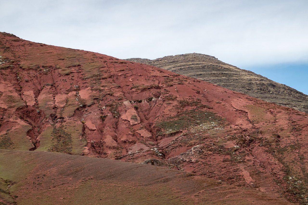
Palccoyo (also spelled Palcoyo) is a separate set of striped ridges near Checacupe, about a four-hour drive from Cusco. The trailhead sits at roughly 4,700 metres and the main viewpoint at around 4,880 to 4,900 metres. The walk is about 4 km round trip on purpose-built, well-graded paths — roughly 35 minutes out and 20 minutes back. There is an optional extension to a stone forest at just under 4,960 metres if you want more.
The differences that matter:
- You gain about 200 metres, not 400. And you do it on a gentle gradient rather than a lung-emptying final pitch.
- There are three coloured ridges, not one. Arguably a better composition, and you can see them from multiple angles rather than from one queue.
- The trails were actually built. Vinicunca’s paths are just places where people have walked. Palccoyo’s were designed, which is better underfoot and much better for the hillside.
- The crowds are a fraction. Hundreds a day rather than one to two thousand.
- Entry is around S/20, with a separate charge if you want to fly a drone.
- Tours run from around USD 34 in a group, or roughly S/400 for a private taxi.
The trade-off is honest: the single ridge at Vinicunca is more dramatic than any one ridge at Palccoyo, and if the weather is perfect Vinicunca is the better photograph. You also give up the bragging rights of 5,036 metres.
A clear decision rule
Take Palccoyo instead of Vinicunca if any of these is true:
- You have had fewer than three nights above 3,000 metres.
- You are travelling with children, with anyone over about 65, or with anyone who has a heart or lung condition.
- You have had a headache or poor sleep in Cusco that has not fully resolved.
- Crowds actively ruin places for you.
- You are visiting between November and March, when the snow risk is highest — Palccoyo’s lower ridges are less often buried.
- You want to be back in Cusco with an evening left rather than face-down in your hotel.
Take Vinicunca if you have acclimatised properly, you are travelling in the dry season, you want the harder objective, and you accept you may get a grey ridge.
Vinicunca vs Palccoyo vs Ausangate 7 Lakes
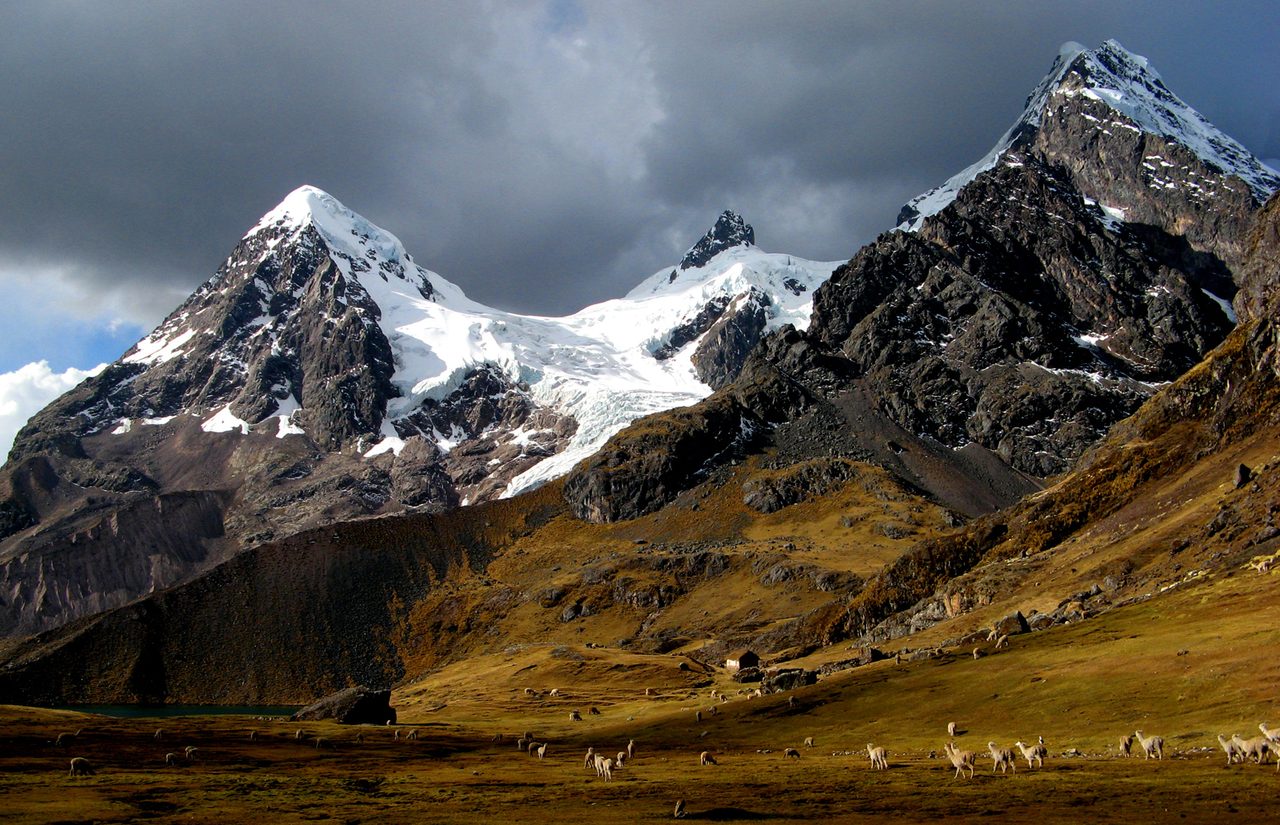
The third option is the one almost nobody considers and several people should. The Siete Lagunas circuit sits beneath Ausangate, the 6,384-metre glaciated peak that dominates the skyline south-east of Cusco, and it trades stripes for turquoise glacial lakes.
| Vinicunca | Palccoyo | Ausangate 7 Lakes | |
|---|---|---|---|
| Highest point | ~5,036 m | ~4,900 m | ~4,800–4,850 m |
| Trailhead | ~4,600 m | ~4,700 m | ~4,400 m |
| Walk | ~6 km round trip, ~400 m gain | ~4 km round trip, ~200 m gain | 8–10 km, rolling |
| Time on foot | 2.5–4 hours | 1–1.5 hours | 3–6 hours |
| Total day | 12–14 hours | 10–12 hours | 13–15 hours |
| Difficulty | Hard for the altitude, easy underfoot | Moderate | Hard for the distance |
| Group tour cost | USD 35–65 | From USD 34 | USD 30–45 |
| Entrance | S/25–30 | ~S/20 | ~S/10 per checkpoint |
| Crowds in season | 1,000–1,500/day, over 2,000 at peak | Hundreds | Low |
| Weather sensitivity | Very high — snow hides the colours | High, but lower and less often buried | Lower — lakes look good in most conditions |
| Verdict | The icon. Worth it if acclimatised and lucky. | The sensible default for most visitors. | The best value and the quietest. Underrated. |
If you have the legs and the acclimatisation, Ausangate 7 Lakes is the one I would push hardest. It is a longer walk but a lower one, the scenery is consistently good regardless of light, and you will not queue for anything. It also functions as a taster for the full Ausangate circuit, which is one of the finest multi-day treks in the country.
The crowds, and why arrival time is everything
Some real numbers, because the vague “it gets busy” framing does not help you plan.
In 2015, Vinicunca was receiving something like 30 visitors a month. By 2016 that had become around 400 a day. Cusco’s regional tourism directorate has put high-season traffic at roughly 1,500 people a day, a figure that has held remarkably steady in official statements from 2019 through to early 2026, and Peruvian press reporting in late 2025 described daily numbers passing 2,000 at peak. On a bad-weather day it might be 500. On a July or August Saturday it is at the top of that range.
You will occasionally see “3,000 a day” quoted. I could not find a credible source for that figure and I would not plan around it. Over 2,000 is the honest ceiling.
Here is what those numbers mean physically. The viewpoint is a narrow ridge with room for maybe a dozen people at a time in the good spot. Everyone arrives in a compressed window between about 9:30am and 11:30am, because everyone left Cusco at the same time in the same convoy of minibuses. So the queue for the photo can run 20 to 40 minutes, in wind, at 5,000 metres, which is a genuinely unpleasant place to stand still.
Two ways around it. Be first up. If your tour is at the trailhead by 8:15am and you walk at a steady pace without stopping for the photo ops on the way, you can be at the ridge before the bulk arrives. Or be last. Some operators now run a deliberately later departure that reaches the ridge around 1pm as everyone else is leaving. That is a real strategy, but you are betting on the afternoon cloud holding off, and it often does not.
The other crowd fact worth knowing: the mountain now sees a meaningful share of the visitors who come to Cusco, and it has become a fixture on almost every list of the places people want to see in Peru. It is not an obscure corner of the Andes any more, and pretending otherwise sets you up for disappointment.
What to wear and carry at 5,000 metres
The temperature swing is the thing people get wrong. At the trailhead before 9am it is commonly below freezing with a hard wind. By 10:30am, with the sun up and no shade anywhere, it can be 8 to 12 °C and feel considerably warmer while you are climbing. You need to be able to shed and re-add layers in two minutes.
Wear and pack:
- A thermal base layer, a fleece or light down mid-layer, and a genuinely windproof shell. The wind is the problem, not the air temperature.
- Long trousers — hiking trousers or leggings under something. Shorts are a mistake here.
- Proper walking shoes or boots with grip. The trail is dust and loose stone, and it turns to slick mud in the wet season.
- Gloves and a warm hat for the morning, and a sun hat for later. You will want both on the same day.
- Sunglasses. Non-negotiable. UV at this altitude is far stronger than at sea level and snow reflects most of it back at you.
- Sunscreen, SPF 50, on your face, ears, neck and the underside of your nose. Sunburn at 5,000 metres is fast and vicious.
- Two litres of water, minimum. Dehydration makes altitude symptoms worse and everyone underestimates this.
- Snacks you will actually eat when you have no appetite — something salty tends to work better than something sweet.
- Cash in small notes and coins: entrance, toilets, horse, snacks. There is no card payment anywhere on that mountain.
- Trekking poles if you have them. On the descent they save your knees, and on the ascent they give your arms something to do.
- Lip balm. The combination of wind, sun and dry air destroys lips.
Much of this overlaps with what you would take anywhere high in the Andes — the layering logic is the same as what you would pack for Machu Picchu, just colder and with more emphasis on wind. And take altitude seriously in general; the practical health and safety points that apply across Peru matter more here than almost anywhere else in the country.
One thing to skip: a big camera setup, unless photography is the reason you came. Carrying weight at 5,000 metres is a tax you pay on every single step.
When to go, month by month
The dry season runs roughly April to October, and the wet season November to March, with the heaviest rain from December to February.
| Period | Conditions | Verdict |
|---|---|---|
| April–May | Post-rain. Ground still damp, colours often at their richest, landscape green, crowds moderate. | The best window, and underrated. |
| June–August | Driest and clearest, coldest mornings, and by far the busiest. | Most reliable skies, worst crowds. |
| September–October | Still dry, crowds thinning, occasional early rain. | Excellent. My second choice after April–May. |
| November | Rain returning, unpredictable. | A gamble. |
| December–March | Heaviest rain, real snow risk, trail mud, occasional closures. | Go to Palccoyo, or skip it. |
That April–May recommendation surprises people who assume peak dry season is automatically best. Damp ground makes the mineral colours deeper, the surrounding puna is green rather than straw-coloured, and the ridge is not a queue. It lines up neatly with the shoulder-season case for visiting Peru generally.
Who owns this mountain
It is worth understanding what you are buying into, because this is not a national park and the money does not go to a conservation agency.
Vinicunca emerged as a destination somewhere around 2013 to 2016. The commonly repeated story — that a glacier melted off it — is a simplification. What local elders and regional cultural officials describe is that the peak received regular seasonal snow cover until roughly the early 1990s, and that as snow retreated the coloured slope became consistently visible. Photographs began circulating around 2013 to 2015, an international listicle picked it up in 2017, and the rest followed fast.
The land belongs to Andean communities in the districts of Cusipata and Pitumarca — Chillihuani, Llacto, Pampachiri, Titinco and others. They run the access, collect the fee, provide the horses, and staff the trailside stalls. Around 500 villagers returned to ancestral land to work in tourism as the boom took off. That is a genuinely significant local economy, and by 2024 the site was reportedly generating on the order of S/30,000 a day in gate revenue. It is also why the dispute over who administers those takings has been so bitter.
The environmental cost is real and documented. An investigation published in 2018 found that the main trail had eroded badly within eighteen months, widening in places from a footpath to ten and even twenty metres of bare ground, destroying the fringing vegetation. A wetland at the base — formerly used by migrating ducks — was flattened into a car park roughly the size of five football pitches. The ducks did not come back. A Peruvian biologist quoted at the time put it as bluntly as anyone has: from an ecological point of view, they are killing the goose that lays the golden eggs.
And then there is the mining chapter, which is worth telling accurately because it is usually told wrong. In March 2015, Minquest Perú S.A.C. — the Peruvian subsidiary of the Canadian company Camino Minerals — petitioned the geological institute INGEMMET for a mining concession over roughly 400 hectares covering the mountain, targeting the red beds themselves. The concession was granted in March 2018. After public protest, the company renounced it in May 2018. That order matters: the company gave it up before the state acted. In November 2018 a presidential decree suspended the admission of new mining claims over the coloured mountain for twelve months, and in 2019 the surrounding Ausangate area was finally established as a regional conservation area, something that had been proposed and failed a decade earlier.
So: a mountain uncovered by a warming climate, opened by a road, monetised by communities with no formal framework, briefly nearly mined, and now walked on by up to two thousand people a day. All of that is happening under your boots. It does not mean you shouldn’t go. It means walk on the existing path rather than cutting a new one, take your rubbish down, pay the fee without haggling, and tip the horse handler.
Booking: how to pick an operator
The price spread on this trip is enormous and the differences are not cosmetic.
Ask these four questions before you pay:
- Do you carry an oxygen tank and a pulse oximeter? The answer should be immediate and specific. This is the single best filter.
- How many people per guide? Budget tours put twenty-plus people on a bus with one guide, which means that when someone gets into trouble halfway up, either they are left or the group is. Twelve or fewer is what you want.
- Is the entrance fee included? Usually not. Get a straight answer so you know what cash to carry.
- What time does the bus reach the trailhead? Before 8:30am and you beat the queue. After 9:30am and you are in it.
Booking in Cusco is cheaper than booking from home and gives you the option to wait for a good forecast — a real advantage on a trip this weather-dependent. Booking in advance online gives you better-vetted operators and English-language recourse if something goes wrong. If you are staying a few days in the city anyway, and most itineraries build in a Cusco base, I would book locally, two or three days out, after looking at the weather.
One more practical note: eat properly the night before but not heavily, and skip the alcohol. Cusco’s altitude amplifies it, and the local food is rich enough that a big meal plus a 3am alarm plus 5,000 metres is a combination that ends badly for a lot of people.
Is it worth it? My verdict
Yes, with conditions attached — and I would put those conditions more strongly than any tour company will.
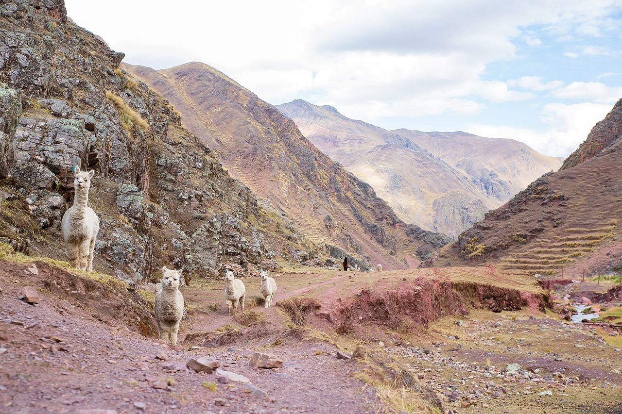
It is worth it if you have spent at least three nights acclimatising, you are going between April and October, you have booked an operator that carries oxygen, and you have made peace with the possibility of a grey ridge. Under those conditions it is a genuinely remarkable place: a striped hillside at an altitude most people will never otherwise reach, in a corner of the Andes with Ausangate looming behind you and alpaca herds on the slopes. The walk itself, once you are moving slowly enough, is oddly meditative.
It is not worth it if you are squeezing it into a short trip, if you have not acclimatised, if you are chasing the photograph you saw online, or if the idea of queueing at 5,000 metres makes you tired just reading it. In those cases you will spend fourteen hours to be cold, breathless and mildly disappointed, and that time would be better spent in almost any other part of the country.
Where does it rank? It is not in the top three things to do in Peru. It is not close to Machu Picchu, and if you are weighing that up, the case for and against the citadel is a different and much easier argument. Vinicunca is a strong second-tier attraction that has been marketed like a first-tier one. Judged as what it actually is — a hard, high, colourful day walk with a crowd problem — it holds up perfectly well.
And if any part of the honest version above gave you pause, go to Palccoyo. You will see three coloured ridges instead of one, you will not queue, you will be back in Cusco for dinner, and you will not spend the afternoon wondering whether the headache is going to turn into something worse. There is no medal for the harder option.
Frequently asked questions
How high is Rainbow Mountain?
The viewpoint sits at approximately 5,036 metres (16,522 feet), though tour operators and many signs advertise 5,200 metres. The trailhead on the Cusipata side is around 4,600 metres, so you climb roughly 400 metres. For comparison, Everest Base Camp in Nepal is 5,364 metres and the highest pass on the Inca Trail is 4,215 metres.
How difficult is the hike?
Technically easy, physically hard. There is no scrambling or exposure — it is a walking trail the whole way. The difficulty comes entirely from the altitude, where each breath delivers roughly half the oxygen of one at sea level. Fit people who have not acclimatised struggle badly; unfit people who have acclimatised for a week often do fine.
How long is the walk?
Roughly 3 km each way from the standard Cusipata trailhead, around 6 km round trip, with about 400 metres of climbing. Most people take 1.5 to 2.5 hours up and 1 to 1.5 hours down. GPS tracks of the common variants come out between 5.1 and 7.1 km depending on where vehicles stop.
How much is the entrance fee?
Generally S/25 for foreign adults and S/15 for Peruvians, though the communities announced S/30 and S/20 in 2024 and rates have shifted with the ongoing administration dispute. Carry S/30 in cash, in soles. It cannot be paid online or by card, and it is usually not included in your tour price.
How many days should I acclimatise in Cusco first?
Three full nights at 3,400 metres is my minimum, and four or five is better. Two nights is what a lot of itineraries allow and it is not enough. If you have fewer than three, do Palccoyo instead.
Can I ride a horse to the top?
Part of the way. Horses run from near the trailhead to a point roughly 400 metres short of the lower viewpoint, at which point the ground is too steep and narrow and you walk the rest — about 15 to 25 minutes, and it is the hardest section of the day. Expect S/60–100 one way or around S/100 return, cash, paid directly to the handler.
Are the colours as bright as the photos?
No. The photographs that made the mountain famous are heavily saturated. In reality you are looking at muted bands of turquoise, ochre, maroon, cream and green on a large brown hill. It is striking and unusual. It is not neon. Overcast light flattens it further, and snow can hide it completely.
What happens if the mountain is covered in snow?
You still do the drive, still pay the fee, still walk up, and you see a white hill. There is no refund and no weather guarantee — you are buying transport and a guide, not a view. Snow cover is most likely between October and March, and in February 2026 the mountain was completely buried.
What time do tours leave Cusco?
Between 3am and 4am for the standard departure, because clouds build over the range through the morning and a ridge that is clear at 9am is often invisible by 1pm. Some operators offer a later start that arrives around lunchtime, which avoids the crowds but takes a real weather risk.
How long is the whole day?
Twelve to fourteen hours door to door, sometimes more. Pickup around 3–4am, back in Cusco between 5pm and 7pm. Do not schedule anything important that evening, and do not book it the day before an early flight.
How crowded does it get?
Roughly 1,000 to 1,500 people a day in high season according to Cusco’s regional tourism figures, with reports of over 2,000 at peak. Everybody arrives within the same two-hour window, so the photo spot on the ridge can involve a 20 to 40 minute queue. In 2015 the site saw around 30 visitors a month.
Vinicunca or Palccoyo — which should I choose?
Palccoyo for most people: lower, much gentler, purpose-built trails, three ridges instead of one, and a fraction of the crowds. Vinicunca if you are properly acclimatised, travelling in the dry season, and want the harder, higher, more dramatic single ridge. Nobody should choose Vinicunca purely because it is the famous one.
Is there anywhere to use the toilet?
Yes, at the trailhead and at a couple of points along the route, for around S/1 each time. Bring coins. Facilities are basic and there is nothing at the summit.
Can I visit without a tour?
Yes. Take a colectivo south from Cusco towards Cusipata or Checacupe (roughly S/10–15, two to two and a half hours), then hire a taxi up to the trailhead, which will run somewhere around S/100–120 for the vehicle. You will arrive late morning, after the tour convoy, which is either an advantage or a disaster depending on the cloud. Split between three or four people it is cheaper than a tour, and you set your own pace.
Should I do this before or after Machu Picchu?
After, if the sequence is flexible. Machu Picchu is at 2,430 metres and asks nothing of you physically, so it works well early in a trip while you are still adjusting, whereas Vinicunca needs your acclimatisation to be well established. Working out how many days to allow around the citadel first, then slotting Vinicunca in afterwards, tends to produce a better-paced week.
Is it safe?
The trail itself is safe underfoot. The altitude is the hazard, and it is a real one — tourists have died at Vinicunca in recent years, and lightning strikes on the exposed ridge have killed people at the site. Go with an operator carrying oxygen and a pulse oximeter, acclimatise properly, turn around if you feel genuinely unwell rather than pushing on, and treat a worsening headache with nausea as a reason to descend immediately.
What else is worth doing while I am in the area?
The Red Valley add-on at the ridge itself, if you have the energy. Otherwise the Cusco region has more than enough to fill a week — the ruins circuit above the city, the Sacred Valley towns, and the wider spread of Inca sites across the country. Vinicunca is a single hard day inside a much bigger trip, and it should be planned as one.